|
search place name
|
||
Kampong Lahar Tiang (Pulau Pinang, Malaysia)Kampong Lahar Tiang is a town in the Pulau Pinang region of Malaysia. An overview map of the region around Kampong Lahar Tiang is displayed below.
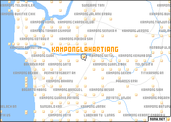
regional and 3d topo map of Kampong Lahar Tiang, Malaysia ::
Kampong Lahar Tiang airports ::
The nearest airport is PEN - Penang Intl, located 36.1 km south west of Kampong Lahar Tiang.
Other airports nearby include AOR - Alor Setar Sultan Abdul Halim (71.4 km north), LGK - Pulau Langkawi Intl (120.1 km north west), IPH - Ipoh Sultan Azlan Shah (127.9 km south east), HDY - Songkhla Hat Yai Intl (153.3 km north), Nearby towns ::
Kampong Tambang (1.8km west) //
Kampong Permatang Durian (1.8km west) //
Kampong Matang Kedundong (1.9km north) //
Kampong Petaseh Langsat (1.8km east) //
Kampong Siam (1.8km east) //
Permatang Setar (1.8km east) //
Kampong Jawa (2.6km north west) //
Tanjong Putus (2.6km north west) //
Pokok Jenereh (2.6km south east) //
Kampung Pinang Tunggal (2.6km north east) //
Kampong Sungai Korok (2.6km south east) //
Kampong Tasok (2.6km south east) //
Kampong Paya Keladi (3.7km west) //
Kampong Tok Bedu (3.7km south) //
Kampong Matang Berangah (3.7km north) //
Kampong Setul (3.7km east) //
Kampong Pokok Asam (4.1km north west) //
Kampong Pantai Kapas (4.1km north west) //
Kampong Pokok Kabu (4.1km north west) //
Kampong Seberang Tok Soh (4.1km north east) //
Kampong Baharu (4.1km south east) //
Kampong Pulau Sepom (5.2km north west) //
Kampong Kepala Bukit (5.2km north west) //
Kampong Kubang Menderong (5.2km south east) //
Kampong Ekor Kuching (5.5km east) //
Permatang Tiga Ringgit (5.5km west) //
Kampong Permatang Tinggi (5.5km west) //
Kampong Pantai Perai (5.5km east) //
Kampong Terat Batu (5.5km east) //
[all distances 'as the bird flies' and approximate] 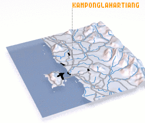 Places with similar names to Kampong Lahar Tiang, Malaysia :: Disclaimer :: Information on this page comes without warranty of any kind |
||
|
Where is Kampong Lahar Tiang? Elevation and coordinates ::
Latitude (lat): 5°33'0"N Longitude (lon): 100°29'0"E
Elevation (approx.): 5m (map arrows pan, magnifying glasses zoom) |
||
|
Visiting Kampong Lahar Tiang? Hotel/Accommodation ::
Book a hotel in Kampong Lahar Tiang Travel Guide ::
Buy a travel guide for Malaysia rental cars ::
car rental offers GPS waypoint ::
download a GPX waypoint (PoI) of Kampong Lahar Tiang for your GPS receiver
|
||