|
search place name
|
||
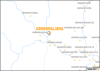
Kampong Liang (Pahang, Malaysia)Kampong Liang is a town in the Pahang region of Malaysia. An overview map of the region around Kampong Liang is displayed below.
regional and 3d topo map of Kampong Liang, Malaysia ::
Kampong Liang airports ::
The nearest airport is IPH - Ipoh Sultan Azlan Shah, located 85.1 km west of Kampong Liang.
Other airports nearby include KUA - Kuantan (165.8 km east), KUL - Kuala Lumpur Intl (174.1 km south), KTE - Kerteh (180.4 km east), TGG - Kuala Terengganu Sultan Mahmud (185.1 km north east), Nearby towns ::
Kampung Kuala Medang (1.9km south) //
Kampong Keluyong (3.7km south) //
Kampong Kurau (3.7km west) //
Kampong Kermoi (4.1km south east) //
Kampong Jelai Kechil (4.1km south west) //
Kampong Tanjong Gahai (6.7km south east) //
Kampong Paya Buloh (6.7km south east) //
Kampong Kapor (7.9km south east) //
Kampung Inkiang (10.5km north west) //
Kampong Bertam (10.5km south east) //
[all distances 'as the bird flies' and approximate]  Places with similar names to Kampong Liang, Malaysia ::
// Kampong Leoong (MY)
// Kampong Lingai (MY)
// Kampong Linggi (MY)
// Kampong Lonek (MY)
// Kampong Longgo (MY)
// Kampong Olong (MY)
// Kampung Gelang (MY)
// Kampong Galang (MY)
// Kampong Galong (MY)
// Kampong Gelang (MY)
Disclaimer :: Information on this page comes without warranty of any kind |
||
|
Where is Kampong Liang? Elevation and coordinates ::
Latitude (lat): 4°19'0"N Longitude (lon): 101°49'0"E
Elevation (approx.): 149m (map arrows pan, magnifying glasses zoom) |
||
|
Visiting Kampong Liang? Hotel/Accommodation ::
Book a hotel in Kampong Liang Travel Guide ::
Buy a travel guide for Malaysia rental cars ::
car rental offers GPS waypoint ::
download a GPX waypoint (PoI) of Kampong Liang for your GPS receiver
|
||