|
search place name
|
||
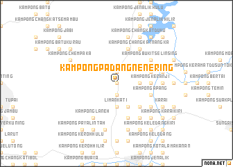
Kampong Padang Nenering (Perak, Malaysia)Kampong Padang Nenering is a town in the Perak region of Malaysia. An overview map of the region around Kampong Padang Nenering is displayed below.
regional and 3d topo map of Kampong Padang Nenering, Malaysia ::
Kampong Padang Nenering airports ::
The nearest airport is IPH - Ipoh Sultan Azlan Shah, located 40.9 km south east of Kampong Padang Nenering.
Other airports nearby include PEN - Penang Intl (82.9 km north west), AOR - Alor Setar Sultan Abdul Halim (154.8 km north), NAW - Narathiwat (203.7 km north east), LGK - Pulau Langkawi Intl (206.0 km north west), Nearby towns ::
Kampong Terap (0.0km north) //
Kati (0.0km north) //
Kampong Tiong (1.9km south) //
Kampong Paya Pong Seri (1.9km south) //
Kampong Changkat Jambu (1.9km south) //
Kampong Ulu Kati (1.9km south) //
Kampong Paya Stuna (1.9km south) //
Kampong Ulu Tiong (1.9km south) //
Kampong Chuar (1.9km north) //
Kampong Berhala (3.7km east) //
Kampong Lata (3.7km east) //
Kampong Cheh (3.7km east) //
Liman Kati (3.7km south) //
Kampong Ulu Ribu (4.1km south east) //
Kampong Maran (5.2km south east) //
Kampong Keranji (5.5km east) //
Kampong Jarau (5.5km east) //
Kampong Apang (5.8km east) //
Kampong Temong (5.8km east) //
Kampong Periang (5.8km east) //
Kampong Pengkalan (5.8km east) //
Sauk (5.9km north) //
Kampong Langkor (5.9km south) //
Kampong Ulu Langkor (5.9km south) //
Kampong Tahan Hilir (5.8km east) //
Kampong Changkat Nangka (6.7km north east) //
Kampong Baharu (6.7km north east) //
Kampong Seteru (6.7km north east) //
Kampong Biong (6.7km north east) //
[all distances 'as the bird flies' and approximate] 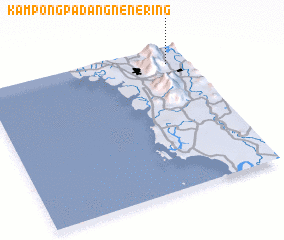 Places with similar names to Kampong Padang Nenering, Malaysia ::
// Kampong Padang Nangka (MY)
// Kampung Padang Gunong (MY)
Disclaimer :: Information on this page comes without warranty of any kind |
||
|
Where is Kampong Padang Nenering? Elevation and coordinates ::
Latitude (lat): 4°53'0"N Longitude (lon): 100°54'0"E
Elevation (approx.): 70m (map arrows pan, magnifying glasses zoom) |
||
|
Visiting Kampong Padang Nenering? Hotel/Accommodation ::
Book a hotel in Kampong Padang Nenering Travel Guide ::
Buy a travel guide for Malaysia rental cars ::
car rental offers GPS waypoint ::
download a GPX waypoint (PoI) of Kampong Padang Nenering for your GPS receiver
|
||