|
search place name
|
||
Kampong Padang Raja (Kedah, Malaysia)Kampong Padang Raja is a town in the Kedah region of Malaysia. An overview map of the region around Kampong Padang Raja is displayed below.
regional and 3d topo map of Kampong Padang Raja, Malaysia ::

Kampong Padang Raja airports ::
The nearest airport is AOR - Alor Setar Sultan Abdul Halim, located 13.8 km north east of Kampong Padang Raja.
Other airports nearby include LGK - Pulau Langkawi Intl (72.3 km west), PEN - Penang Intl (87.2 km south), HDY - Songkhla Hat Yai Intl (94.2 km north), PAN - Pattani (119.4 km north east), Nearby towns ::
Kampong Hutan Putus (0.0km north) //
Kampong Telaga Tok Tong (0.0km north) //
Kampong Pergam (1.9km south) //
Kampong Lahar Pumpong (1.9km south) //
Kampong Alor Ibus (1.9km south) //
Kampong Telok Kechai (1.8km west) //
Kampong Ujong Telok Kechal (1.8km west) //
Kampong Hujong Alor (1.8km east) //
Kampong Telok Chengai (1.9km north) //
Kampong Klong Hoi (1.9km north) //
Kampong Selarong Balak (2.6km south west) //
Kampong Tengah (2.6km south east) //
Kampong Padang Tengah (2.6km south east) //
Kampong Telaga Tok Jering (2.6km south east) //
Kampong Telok Bagan (2.6km south east) //
Kampong Akor Peluru (2.6km north east) //
Tambak Bunga (2.6km north east) //
Kampong Tebengau (3.7km south) //
Kampong Tandok (3.7km east) //
Kampong Keriang Pulau (3.7km east) //
Kampong Pengkalan Kundor (3.7km east) //
Kampong Pokok Lepai (3.7km east) //
Kampong Batin (3.7km north) //
Kampong Ketayap (3.7km north) //
Kampong Jeragan (3.7km north) //
Kampong Lahar Buaya (4.1km south east) //
Lahar Buloh (4.1km south east) //
Kampong Lahar Kabu (4.1km south east) //
Kampong Lorong (4.1km north west) //
[all distances 'as the bird flies' and approximate] 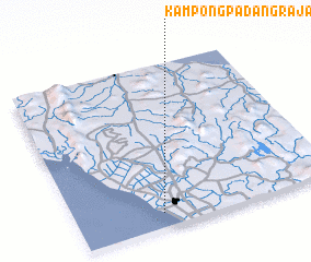 Places with similar names to Kampong Padang Raja, Malaysia ::
// Kampong Padang Raja (MY)
Disclaimer :: Information on this page comes without warranty of any kind |
||
|
Where is Kampong Padang Raja? Elevation and coordinates ::
Latitude (lat): 6°5'0"N Longitude (lon): 100°20'0"E
Elevation (approx.): 4m (map arrows pan, magnifying glasses zoom) |
||
|
Visiting Kampong Padang Raja? Hotel/Accommodation ::
Book a hotel in Kampong Padang Raja Travel Guide ::
Buy a travel guide for Malaysia rental cars ::
car rental offers GPS waypoint ::
download a GPX waypoint (PoI) of Kampong Padang Raja for your GPS receiver
|
||