|
search place name
|
||
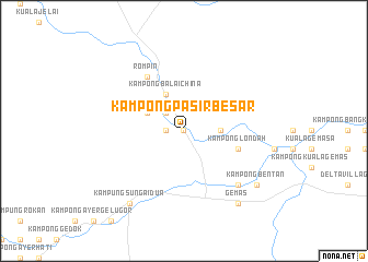
Kampong Pasir Besar (Negeri Sembilan, Malaysia)Kampong Pasir Besar is a town in the Negeri Sembilan region of Malaysia. An overview map of the region around Kampong Pasir Besar is displayed below.
regional and 3d topo map of Kampong Pasir Besar, Malaysia ::
Kampong Pasir Besar airports ::
The nearest airport is MKZ - Malacca, located 53.0 km south west of Kampong Pasir Besar.
Other airports nearby include KUL - Kuala Lumpur Intl (92.2 km west), KUA - Kuantan (145.3 km north east), DUM - Dumai Pinang Kampai (168.0 km south west), JHB - Johor Bahru Sultan Ismail (168.6 km south east), Nearby towns ::
Kampong Sendayan (0.0km north) //
Kampong Lubok Jong (1.9km west) //
Kampong Beriku (2.6km north west) //
Kampong Merbau Saratus (3.7km east) //
Kampong Balai China (4.1km north west) //
Kampong Panjis (4.1km north west) //
Kampong Londah (5.9km east) //
Kampung Rompin (6.7km north west) //
Rompin (6.7km north west) //
Kampong Bangka Hulu (7.9km south east) //
Kampong Ladang (7.9km south east) //
Kampung Sungai Dua (9.3km south west) //
Kampong Bentan (9.3km south east) //
Gemas (9.3km south east) //
[all distances 'as the bird flies' and approximate]  Places with similar names to Kampong Pasir Besar, Malaysia ::
// Kampong Pasir Besar (MY)
// Kampong Pasir Besar (MY)
// Kampong Pasir Besar (MY)
// Kampong Pasir Besar (MY)
Disclaimer :: Information on this page comes without warranty of any kind |
||
|
Where is Kampong Pasir Besar? Elevation and coordinates ::
Latitude (lat): 2°39'0"N Longitude (lon): 102°32'0"E
Elevation (approx.): 43m (map arrows pan, magnifying glasses zoom) |
||
|
Visiting Kampong Pasir Besar? Hotel/Accommodation ::
Book a hotel in Kampong Pasir Besar Travel Guide ::
Buy a travel guide for Malaysia rental cars ::
car rental offers GPS waypoint ::
download a GPX waypoint (PoI) of Kampong Pasir Besar for your GPS receiver
|
||