|
search place name
|
||
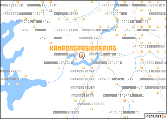
Kampong Pasir Nering (Terengganu, Malaysia)Kampong Pasir Nering is a town in the Terengganu region of Malaysia. An overview map of the region around Kampong Pasir Nering is displayed below.
regional and 3d topo map of Kampong Pasir Nering, Malaysia ::
Kampong Pasir Nering airports ::
The nearest airport is TGG - Kuala Terengganu Sultan Mahmud, located 37.4 km north of Kampong Pasir Nering.
Other airports nearby include KTE - Kerteh (76.5 km south east), KBR - Kota Bahru Sultan Ismail Petra (143.7 km north west), KUA - Kuantan (145.0 km south), NAW - Narathiwat (211.4 km north west), Nearby towns ::
Kampong Temir (1.8km west) //
Kampong Pauh (1.8km west) //
Kampong Kuala Por (1.9km south) //
Kampong Setang (1.8km east) //
Kampong Gaung (1.8km east) //
Kampong Telok Pechong (1.8km east) //
Kampong Buloh (1.8km east) //
Kampong Tanjong Baharu (2.6km north west) //
Kampong Telaga (2.6km north east) //
Kampong Telok Masjid (2.6km north east) //
Kampong Ipoh (2.6km south east) //
Kampong Dusun (3.7km west) //
Kampong Kukuran (3.7km west) //
Kampong Berkoh (3.7km west) //
Kampong Bukit Gemuroh (3.7km south) //
Kampong Kemat (3.7km south) //
Kampong Tanjong Putat (3.7km east) //
Kuala Berang (3.7km east) //
Kampong Kuala Pueh (4.1km north west) //
Kampong Tajin (4.1km north east) //
Kampong Buntut (4.1km north east) //
Kampong Tepas (4.1km south east) //
Kampong Langgar Hilir (5.2km north east) //
Kampong Langgar Ulu (5.2km north east) //
Kampong Bukit Kanchil (5.5km east) //
Kampung Kuala Menjing (5.6km south) //
Kampong Lubok Pahit (5.6km south) //
Kampong Mekan (5.6km south) //
Kampong Bukit Tok Bat (5.8km east) //
[all distances 'as the bird flies' and approximate]  Places with similar names to Kampong Pasir Nering, Malaysia :: Disclaimer :: Information on this page comes without warranty of any kind |
||
|
Where is Kampong Pasir Nering? Elevation and coordinates ::
Latitude (lat): 5°4'0"N Longitude (lon): 102°59'0"E
Elevation (approx.): 16m (map arrows pan, magnifying glasses zoom) |
||
|
Visiting Kampong Pasir Nering? Hotel/Accommodation ::
Book a hotel in Kampong Pasir Nering Travel Guide ::
Buy a travel guide for Malaysia rental cars ::
car rental offers GPS waypoint ::
download a GPX waypoint (PoI) of Kampong Pasir Nering for your GPS receiver
|
||