|
search place name
|
||
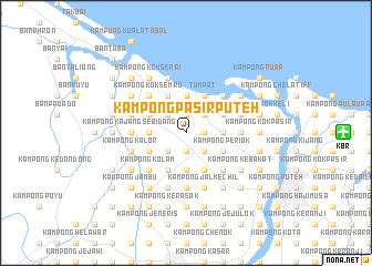
Kampong Pasir Puteh (Kelantan, Malaysia)Kampong Pasir Puteh is a town in the Kelantan region of Malaysia. An overview map of the region around Kampong Pasir Puteh is displayed below.
regional and 3d topo map of Kampong Pasir Puteh, Malaysia ::
Kampong Pasir Puteh airports ::
The nearest airport is KBR - Kota Bahru Sultan Ismail Petra, located 15.8 km east of Kampong Pasir Puteh.
Other airports nearby include NAW - Narathiwat (59.6 km north west), PAN - Pattani (129.7 km north west), TGG - Kuala Terengganu Sultan Mahmud (136.6 km south east), AOR - Alor Setar Sultan Abdul Halim (193.9 km west), Nearby towns ::
Kampong Kok Kebit (1.9km north) //
Kampong Kok Seraya (1.8km east) //
Kampong Pak Endir (1.8km east) //
Kampong Talak (1.9km south) //
Kampong Cherang Melintang (1.9km south) //
Kampong Kubang Gajah (1.9km south) //
Kampong Kelaboran (2.6km north east) //
Kampong Telaga Bata (2.6km north west) //
Kampong Jering (2.6km north west) //
Kampong Nichang (2.6km north west) //
Chabang Empat (2.6km south east) //
Kampong Chenerong (2.6km south west) //
Kampong Bendang Kering (3.7km east) //
Kampong Ayer Dingin (3.7km east) //
Chabang Tiga (3.7km east) //
Kampong Pengkalan Nangka (3.7km north) //
Kampong Kubang Rengit (3.7km west) //
Kampong Jal Besar (3.7km south) //
Kampong Padang Mandor (3.7km south) //
Kampong Ana (3.7km south) //
Kampong Sedar (4.1km north east) //
Kampong Tok Takor (4.1km north east) //
Kampong Binjai (4.1km north east) //
Kampong Terbok (4.1km north east) //
Kampong Kok Kenik (4.1km north west) //
Kampong Bunohan (4.1km north west) //
Tumpat (4.1km north east) //
Kampong Bechah Resak (4.1km south east) //
Kampong Alor Tal (4.1km south east) //
[all distances 'as the bird flies' and approximate] 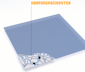 Places with similar names to Kampong Pasir Puteh, Malaysia ::
// Kampong Pasir Puteh (MY)
// Kampong Pasir Puteh (MY)
// Kampong Pasir Puteh (MY)
// Kampong Pasir Puteh (MY)
// Kampong Pasir Puteh (MY)
// Kampong Pasir Puteh (MY)
// Kampong Pasir Puteh (MY)
// Kampong Pasir Puteh (MY)
// Kampung Pasir Puteh (MY)
// Kampung Pasir Putih (MY)
Disclaimer :: Information on this page comes without warranty of any kind |
||
|
Where is Kampong Pasir Puteh? Elevation and coordinates ::
Latitude (lat): 6°10'0"N Longitude (lon): 102°9'0"E
Elevation (approx.): 4m (map arrows pan, magnifying glasses zoom) |
||
|
Visiting Kampong Pasir Puteh? Hotel/Accommodation ::
Book a hotel in Kampong Pasir Puteh Travel Guide ::
Buy a travel guide for Malaysia rental cars ::
car rental offers GPS waypoint ::
download a GPX waypoint (PoI) of Kampong Pasir Puteh for your GPS receiver
|
||