|
search place name
|
||
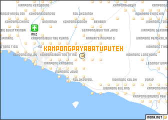
Kampong Paya Batu Puteh (Melaka, Malaysia)Kampong Paya Batu Puteh is a town in the Melaka region of Malaysia. An overview map of the region around Kampong Paya Batu Puteh is displayed below.
regional and 3d topo map of Kampong Paya Batu Puteh, Malaysia ::
Kampong Paya Batu Puteh airports ::
The nearest airport is MKZ - Malacca, located 13.0 km north west of Kampong Paya Batu Puteh.
Other airports nearby include KUL - Kuala Lumpur Intl (93.3 km north west), DUM - Dumai Pinang Kampai (121.1 km south west), JHB - Johor Bahru Sultan Ismail (159.3 km south east), XSP - Singapore Seletar (189.8 km south east), Nearby towns ::
Kampong Paya Dalam (0.0km north) //
Kampong Bukit Kechil (1.9km west) //
Kampong Parit Batu (1.9km west) //
Kampong Gaong (1.9km west) //
Tiang Dua (1.9km north) //
Kampong Tasek (1.9km south) //
Kampong Bukit Durian (1.9km south) //
Kampong Paya Nibong (1.9km east) //
Kampong Bukit Nibong (1.9km east) //
Kampong Bukit Sali (1.9km east) //
Kampong Baroh (2.6km south west) //
Solok Tambak Bugis (2.6km south west) //
Kampong Ayer Molek (2.6km north west) //
Kampong Bukit Larang (2.6km south west) //
Air Molek (3.7km west) //
Kampong Permatang (3.7km west) //
Kampong Parit Keliling (3.7km west) //
Solok Bukit Tembakau (3.7km south) //
Solok Berangan Enam (3.7km south) //
Kampong Bukit Tasek (3.7km east) //
Kampong Bukit Kajang (3.7km east) //
Kampong Bukit Datok (3.7km east) //
Kampong Tanjong Laboh (4.1km north west) //
Kampong Bukit Meta (4.1km south west) //
Kampong Bukit Kechil (4.1km south west) //
Kampong Pernu (4.1km south west) //
Umbai (4.1km south west) //
Kampong Permatang (4.1km south west) //
Kampong Parit Singkat (4.1km south west) //
[all distances 'as the bird flies' and approximate] 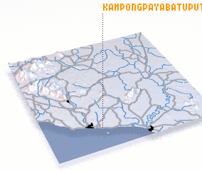 Places with similar names to Kampong Paya Batu Puteh, Malaysia :: Disclaimer :: Information on this page comes without warranty of any kind |
||
|
Where is Kampong Paya Batu Puteh? Elevation and coordinates ::
Latitude (lat): 2°12'0"N Longitude (lon): 102°21'0"E
Elevation (approx.): 16m (map arrows pan, magnifying glasses zoom) |
||
|
Visiting Kampong Paya Batu Puteh? Hotel/Accommodation ::
Book a hotel in Kampong Paya Batu Puteh Travel Guide ::
Buy a travel guide for Malaysia rental cars ::
car rental offers GPS waypoint ::
download a GPX waypoint (PoI) of Kampong Paya Batu Puteh for your GPS receiver
|
||