|
search place name
|
||
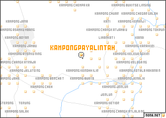
Kampong Paya Lintah (Perak, Malaysia)Kampong Paya Lintah is a town in the Perak region of Malaysia. An overview map of the region around Kampong Paya Lintah is displayed below.
regional and 3d topo map of Kampong Paya Lintah, Malaysia ::
Kampong Paya Lintah airports ::
The nearest airport is IPH - Ipoh Sultan Azlan Shah, located 38.4 km south east of Kampong Paya Lintah.
Other airports nearby include PEN - Penang Intl (82.8 km north west), AOR - Alor Setar Sultan Abdul Halim (159.9 km north), LGK - Pulau Langkawi Intl (208.4 km north west), NAW - Narathiwat (212.8 km north east), Nearby towns ::
Kampong Keroh Hulu (1.9km south) //
Kampong Keroh (1.9km south) //
Kampong Labu Kubong (1.8km east) //
Kampong Laneh (2.6km north east) //
Kampong Rambong (3.7km east) //
Kampong Jelapang (3.7km east) //
Kampong Pulau (3.7km south) //
Kampong Lalang (3.7km south) //
Kampong Keroh Hilir (3.7km south) //
Kampong Gemuroh (4.1km south east) //
Kampong Setor (4.1km south east) //
Kampong Kubang Buaya (4.1km south east) //
Kampong Paya (4.1km south east) //
Kampong Buaya (5.6km south) //
Padang Rengas (5.6km south) //
Kampong Lembah (5.9km south) //
Kampong Kubang Panjang (5.8km east) //
Kampung Lubuk Merbau (5.8km east) //
Kampong Pasir (5.8km east) //
Kampong Jenalik (5.8km east) //
Kampong Bendang Kering (6.7km south east) //
Liman Kati (6.7km north east) //
Kampong Suak Larah (6.7km south east) //
Kampong Rasau (7.4km east) //
Kampong Kekabu Hutan (7.4km east) //
Kampong Tanah Merah (7.4km east) //
Kampong Ulu Langkor (7.6km east) //
Kampong Langkor (7.6km east) //
Kampong Serdang (7.6km east) //
[all distances 'as the bird flies' and approximate]  Places with similar names to Kampong Paya Lintah, Malaysia ::
// Kampong Paya Lintah (MY)
Disclaimer :: Information on this page comes without warranty of any kind |
||
|
Where is Kampong Paya Lintah? Elevation and coordinates ::
Latitude (lat): 4°49'0"N Longitude (lon): 100°51'0"E
Elevation (approx.): 84m (map arrows pan, magnifying glasses zoom) |
||
|
Visiting Kampong Paya Lintah? Hotel/Accommodation ::
Book a hotel in Kampong Paya Lintah Travel Guide ::
Buy a travel guide for Malaysia rental cars ::
car rental offers GPS waypoint ::
download a GPX waypoint (PoI) of Kampong Paya Lintah for your GPS receiver
|
||