|
search place name
|
||
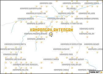
Kampong Pilah Tengah (Negeri Sembilan, Malaysia)Kampong Pilah Tengah is a town in the Negeri Sembilan region of Malaysia. An overview map of the region around Kampong Pilah Tengah is displayed below.
regional and 3d topo map of Kampong Pilah Tengah, Malaysia ::
Kampong Pilah Tengah airports ::
The nearest airport is MKZ - Malacca, located 46.8 km south of Kampong Pilah Tengah.
Other airports nearby include KUL - Kuala Lumpur Intl (54.9 km west), DUM - Dumai Pinang Kampai (146.2 km south west), KUA - Kuantan (164.8 km north east), JHB - Johor Bahru Sultan Ismail (200.0 km south east), Nearby towns ::
Kampong Ulu Gamin (1.9km north) //
Kampong Ulu Pilah (1.9km west) //
Kampung Gancung (2.6km north east) //
Kampong Juar (2.6km north west) //
Kampong Ayer Titian (2.6km north west) //
Kampong Tanah Datar (3.7km west) //
Kampong Kuala Gamin (3.7km north) //
Kampong Sikai (4.1km south west) //
Kampong Cheriau (4.1km north east) //
Kampong Terap (4.1km north east) //
Kampong Tanah Melintang (4.1km north east) //
Kampong Angga Bisa (4.1km north east) //
Kampong Tanjong Beringin (4.1km north west) //
Seri Menanti (4.1km north west) //
Kampong Tengah (4.1km north west) //
Kampong Panglang (4.1km north west) //
Kampong Padang Biawas (5.6km west) //
Kampong Merual (5.6km west) //
Kampong Tanjong Ipoh (5.6km north) //
Kampong Galau (5.9km west) //
Kampong Jumbang (5.9km west) //
Kampong Simpai (5.9km west) //
Kampong Mertang (5.9km west) //
Kampong Gunong Pasir (5.9km west) //
Kampong Pulau (5.9km west) //
Kampong Bukit Melintang (5.9km west) //
Kampong Bukit Tempurong (5.9km west) //
Kampong Buyau (5.9km west) //
Kampong Senaling (5.9km east) //
[all distances 'as the bird flies' and approximate] 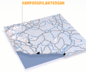 Places with similar names to Kampong Pilah Tengah, Malaysia ::
// Kampong Pilting (MY)
// Kampong Pulau Tengah (MY)
// Kampong Pulau Tengah (MY)
// Kampong Pulau Tengah (MY)
// Kampong Pulau Tengah (MY)
// Kampong Pulau Tengah (MY)
Disclaimer :: Information on this page comes without warranty of any kind |
||
|
Where is Kampong Pilah Tengah? Elevation and coordinates ::
Latitude (lat): 2°41'0"N Longitude (lon): 102°12'0"E
Elevation (approx.): 216m (map arrows pan, magnifying glasses zoom) |
||
|
Visiting Kampong Pilah Tengah? Hotel/Accommodation ::
Book a hotel in Kampong Pilah Tengah Travel Guide ::
Buy a travel guide for Malaysia rental cars ::
car rental offers GPS waypoint ::
download a GPX waypoint (PoI) of Kampong Pilah Tengah for your GPS receiver
|
||