|
search place name
|
||
Kampong Pulau Manis Naga Mengulor (Terengganu, Malaysia)Kampong Pulau Manis Naga Mengulor is a town in the Terengganu region of Malaysia. An overview map of the region around Kampong Pulau Manis Naga Mengulor is displayed below.
regional and 3d topo map of Kampong Pulau Manis Naga Mengulor, Malaysia ::

Kampong Pulau Manis Naga Mengulor airports ::
The nearest airport is TGG - Kuala Terengganu Sultan Mahmud, located 16.6 km north east of Kampong Pulau Manis Naga Mengulor.
Other airports nearby include KTE - Kerteh (90.1 km south east), KBR - Kota Bahru Sultan Ismail Petra (130.4 km north west), KUA - Kuantan (164.2 km south), NAW - Narathiwat (200.3 km north west), Nearby towns ::
Kampong Serada (0.0km north) //
Kampong Kenerak (1.9km south) //
Kampong Batu Hampar (1.9km north) //
Kampong China Hak (1.9km north) //
Kampong Kubang Palas (1.9km south) //
Kampung Pulau Manis (1.8km east) //
Kampong Banggol Kemang (1.8km east) //
Kampong Tirok (2.6km south east) //
Kampong Peradong (2.6km north east) //
Kampong China (2.6km south east) //
Kampong Dusun Melintang (3.7km north) //
Kampung Kuala Telemung (3.7km south) //
Kampong Belu Sindor (3.7km north) //
Kampong Tok Mat (3.7km north) //
Kampong Pasir Tinggi (3.7km south) //
Kampong Kubang Teras (3.7km south) //
Kampong Pantai Ali (3.7km south) //
Kampong Tanjong Mesah (3.7km south) //
Kampong Tok Imam Lapar (3.7km south) //
Kampong Pelam (4.1km south west) //
Kampung Pulau Babi (4.1km north east) //
Kampong Padang Machang (5.2km north east) //
Kampong Padang Raja (5.2km south east) //
Kampong Bukit Damar (5.2km south east) //
Kampong Kesom (5.6km north) //
Kampong Chepoh (5.6km south) //
Kampong Bukit Betiti (5.6km north) //
Kampong Dusun Pinang (5.6km north) //
Kampong Bukit Cherana (5.5km east) //
[all distances 'as the bird flies' and approximate] 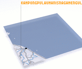 Places with similar names to Kampong Pulau Manis Naga Mengulor, Malaysia :: Disclaimer :: Information on this page comes without warranty of any kind |
||
|
Where is Kampong Pulau Manis Naga Mengulor? Elevation and coordinates ::
Latitude (lat): 5°15'0"N Longitude (lon): 103°2'0"E
Elevation (approx.): 2m (map arrows pan, magnifying glasses zoom) |
||
|
Visiting Kampong Pulau Manis Naga Mengulor? Hotel/Accommodation ::
Book a hotel in Kampong Pulau Manis Naga Mengulor Travel Guide ::
Buy a travel guide for Malaysia rental cars ::
car rental offers GPS waypoint ::
download a GPX waypoint (PoI) of Kampong Pulau Manis Naga Mengulor for your GPS receiver
|
||