|
search place name
|
||
Kampong Rotan Sega (Pahang, Malaysia)Kampong Rotan Sega is a town in the Pahang region of Malaysia. An overview map of the region around Kampong Rotan Sega is displayed below.
regional and 3d topo map of Kampong Rotan Sega, Malaysia ::

Kampong Rotan Sega airports ::
The nearest airport is KUA - Kuantan, located 79.9 km north east of Kampong Rotan Sega.
Other airports nearby include KUL - Kuala Lumpur Intl (123.0 km south west), MKZ - Malacca (135.8 km south), KTE - Kerteh (153.5 km north east), IPH - Ipoh Sultan Azlan Shah (205.2 km north west), Nearby towns ::
Kampong Gumai (1.9km north) //
Kampong Pulau Kening (2.6km south east) //
Kampong Kuala Kening (2.6km south east) //
Kampong Pulau Malang (3.7km east) //
Kampong Dalam (3.7km north) //
Kampong Padang Rambal (3.7km north) //
Kampong Talau (3.7km north) //
Kampong Bukit Babi (3.7km north) //
Kampong Machang Gelap (4.1km north east) //
Kampong Chabang Dua (4.1km north east) //
Kampong Pengkalan Terap (4.1km south east) //
Kampong Karai (4.1km south east) //
Kampong Batu Bor (4.1km south east) //
Kampong Kening (4.1km south east) //
Kampong Nyak (4.1km south east) //
Kampong Sentang (4.1km south east) //
Kampong Telok Melati (4.1km north east) //
Kampong Buntut Pulau (4.1km north east) //
Kampong Paya Kerbau (4.1km north west) //
Kampong Pisang (4.1km north west) //
Kampong Tujoh (4.1km north west) //
Kampong Telok Puchong (4.1km south west) //
Kampong Puchong (4.1km south west) //
Kampung Tebing Tinggi (4.1km south west) //
Kampung Cenur (5.2km north east) //
Kampong Sawah (5.2km north east) //
Kampong Raja (5.2km north east) //
Kampong Laman Chinchin (5.2km north west) //
Kampong Kabut (5.2km north west) //
[all distances 'as the bird flies' and approximate] 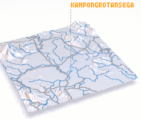 Places with similar names to Kampong Rotan Sega, Malaysia :: Disclaimer :: Information on this page comes without warranty of any kind |
||
|
Where is Kampong Rotan Sega? Elevation and coordinates ::
Latitude (lat): 3°27'0"N Longitude (lon): 102°34'0"E
Elevation (approx.): 51m (map arrows pan, magnifying glasses zoom) |
||
|
Visiting Kampong Rotan Sega? Hotel/Accommodation ::
Book a hotel in Kampong Rotan Sega Travel Guide ::
Buy a travel guide for Malaysia rental cars ::
car rental offers GPS waypoint ::
download a GPX waypoint (PoI) of Kampong Rotan Sega for your GPS receiver
|
||