|
search place name
|
||
Kampong Semut Api (Kelantan, Malaysia)Kampong Semut Api is a town in the Kelantan region of Malaysia. An overview map of the region around Kampong Semut Api is displayed below.
regional and 3d topo map of Kampong Semut Api, Malaysia ::

Kampong Semut Api airports ::
The nearest airport is KBR - Kota Bahru Sultan Ismail Petra, located 3.8 km south of Kampong Semut Api.
Other airports nearby include NAW - Narathiwat (69.4 km north west), TGG - Kuala Terengganu Sultan Mahmud (128.1 km south east), PAN - Pattani (140.7 km north west), AOR - Alor Setar Sultan Abdul Halim (208.6 km west), Nearby towns ::
Kampong Pantai Kundor (1.8km west) //
Pulau Kundor (1.8km west) //
Kampong Pulau Pasir (1.8km west) //
Kampung Pantai Cinta Berahi (1.9km south) //
Kampong Tanjong Dal (2.6km south west) //
Kampong Badang (2.6km south west) //
Kampong Pasir Luas (2.6km south west) //
Kampong Pantai Datok (2.6km south east) //
Kampong Pulau Panjang (2.6km south east) //
Kampong Pulau Gorek (2.6km south east) //
Kampong Telok Katak (3.7km west) //
Pengkalan Cepa (3.7km south) //
Kampong Tok Betek (4.1km south west) //
Kampong Lachor (4.1km south west) //
Kampong Kadai Buloh (4.1km south west) //
Kampong Pantai Mas (4.1km north west) //
Kampong Telok Reba (4.1km south east) //
Kampong Gong Tengah (4.1km south east) //
Kampong Pantai Dasal (4.1km south east) //
Kampong Pulau Pak Amat (4.1km south east) //
Kampong Kijang (5.2km south west) //
Kampong Pulau Kerbau (5.2km south west) //
Kampong Gong Nibong (5.2km south east) //
Kampong Tebing Tinggi (5.2km south east) //
Kampong Telok Kitang (5.2km south east) //
Kampong Che Latiff (5.5km west) //
Kampong Pulau Pisang (5.5km west) //
Kampong Telok Chekering (5.5km west) //
Kampong Baung (5.6km south) //
[all distances 'as the bird flies' and approximate] 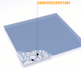 Places with similar names to Kampong Semut Api, Malaysia :: Disclaimer :: Information on this page comes without warranty of any kind |
||
|
Where is Kampong Semut Api? Elevation and coordinates ::
Latitude (lat): 6°12'0"N Longitude (lon): 102°17'0"E
Elevation (approx.): -32768m (map arrows pan, magnifying glasses zoom) |
||
|
Visiting Kampong Semut Api? Hotel/Accommodation ::
Book a hotel in Kampong Semut Api Travel Guide ::
Buy a travel guide for Malaysia rental cars ::
car rental offers GPS waypoint ::
download a GPX waypoint (PoI) of Kampong Semut Api for your GPS receiver
|
||