|
search place name
|
||
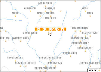
Kampong Seraya (Kedah, Malaysia)Kampong Seraya is a town in the Kedah region of Malaysia. An overview map of the region around Kampong Seraya is displayed below.
regional and 3d topo map of Kampong Seraya, Malaysia ::
Kampong Seraya airports ::
The nearest airport is AOR - Alor Setar Sultan Abdul Halim, located 40.3 km south west of Kampong Seraya.
Other airports nearby include HDY - Songkhla Hat Yai Intl (65.5 km north west), PAN - Pattani (66.1 km north east), LGK - Pulau Langkawi Intl (106.1 km west), NAW - Narathiwat (117.8 km east), Nearby towns ::
Ban Prakop (5.6km north) //
Ban Kham (7.4km north) //
Ban Prakop Ok (7.4km west) //
Ban Mai (8.3km north west) //
Kampong Kuak (10.5km south east) //
[all distances 'as the bird flies' and approximate] 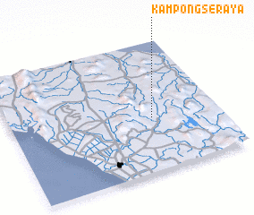 Places with similar names to Kampong Seraya, Malaysia ::
// Kampong Seraya (MY)
Disclaimer :: Information on this page comes without warranty of any kind |
||
|
Where is Kampong Seraya? Elevation and coordinates ::
Latitude (lat): 6°25'0"N Longitude (lon): 100°41'0"E
Elevation (approx.): 76m (map arrows pan, magnifying glasses zoom) |
||
|
Visiting Kampong Seraya? Hotel/Accommodation ::
Book a hotel in Kampong Seraya Travel Guide ::
Buy a travel guide for Malaysia rental cars ::
car rental offers GPS waypoint ::
download a GPX waypoint (PoI) of Kampong Seraya for your GPS receiver
|
||