|
search place name
|
||
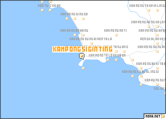
Kampong Si Ginting (Negeri Sembilan, Malaysia)Kampong Si Ginting is a town in the Negeri Sembilan region of Malaysia. An overview map of the region around Kampong Si Ginting is displayed below.
regional and 3d topo map of Kampong Si Ginting, Malaysia ::
Kampong Si Ginting airports ::
The nearest airport is KUL - Kuala Lumpur Intl, located 40.3 km north west of Kampong Si Ginting.
Other airports nearby include MKZ - Malacca (46.0 km east), DUM - Dumai Pinang Kampai (101.5 km south west), KUA - Kuantan (211.8 km north east), JHB - Johor Bahru Sultan Ismail (218.1 km south east), Nearby towns ::
Kampong Tanah Merah (1.9km north) //
Tanjung Tuan (1.9km south) //
Kampong Sungai Menyala (4.1km north east) //
Kampong Telok Kubor (5.6km east) //
Kampung Teluk Kemang (5.6km north) //
Kampong Batu Empat Belas (5.9km east) //
Kampong Sungai Sekawang (5.9km east) //
Kampong Baharu (5.9km north) //
Kampong Balak (7.4km east) //
Pasir Panjang (7.6km east) //
Kampong Telok (7.6km east) //
Kampong Mati (9.3km north east) //
[all distances 'as the bird flies' and approximate]  Places with similar names to Kampong Si Ginting, Malaysia :: Disclaimer :: Information on this page comes without warranty of any kind |
||
|
Where is Kampong Si Ginting? Elevation and coordinates ::
Latitude (lat): 2°25'0"N Longitude (lon): 101°52'0"E
Elevation (approx.): -32768m (map arrows pan, magnifying glasses zoom) |
||
|
Visiting Kampong Si Ginting? Hotel/Accommodation ::
Book a hotel in Kampong Si Ginting Travel Guide ::
Buy a travel guide for Malaysia rental cars ::
car rental offers GPS waypoint ::
download a GPX waypoint (PoI) of Kampong Si Ginting for your GPS receiver
|
||