|
search place name
|
||
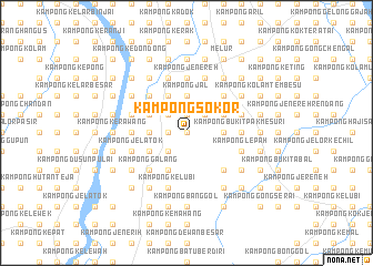
Kampong Sokor (Kelantan, Malaysia)Kampong Sokor is a town in the Kelantan region of Malaysia. An overview map of the region around Kampong Sokor is displayed below.
regional and 3d topo map of Kampong Sokor, Malaysia ::
Kampong Sokor airports ::
The nearest airport is KBR - Kota Bahru Sultan Ismail Petra, located 29.7 km north of Kampong Sokor.
Other airports nearby include NAW - Narathiwat (89.7 km north west), TGG - Kuala Terengganu Sultan Mahmud (108.9 km south east), PAN - Pattani (157.3 km north west), IPH - Ipoh Sultan Azlan Shah (196.6 km south west), Nearby towns ::
Kampong Kuali (0.0km north) //
Lubok Bunut (0.0km north) //
Kampong Che Arus (0.0km north) //
Kampong Mahang (1.9km north) //
Kampong Setek (1.9km north) //
Kampong Batu Tinggi (1.9km north) //
Kampong Banggol Pauh (1.8km west) //
Kampong Banggol Chicha (1.8km west) //
Kampong Bukit China (1.8km west) //
Kampong Baharu (2.6km north east) //
Kampong Paya (2.6km north east) //
Kampong Pupoh (2.6km north east) //
Kampong Banggol Saman (2.6km north east) //
Kampong Jelutong (2.6km north west) //
Kampong Kok Lanas (2.6km north west) //
Kampong Merbau Chondong (2.6km south west) //
Kampong Penambang (3.7km east) //
Kampong Bukit Merbau (3.7km east) //
Kampong Merbau Charok (3.7km east) //
Kampong Sungai Parit (3.7km east) //
Kampong Batu (3.7km east) //
Kampong Bukit Bidang (3.7km east) //
Kampong Lubok Kuin (3.7km north) //
Kampong Jal (3.7km north) //
Kampong Pangkal Petai (3.7km west) //
Kampong Bukit Akar (4.1km north east) //
Kampong Dendang (4.1km north west) //
Kampong Kubang Badak (4.1km south west) //
Kampong Pangkal Nering (4.1km south west) //
[all distances 'as the bird flies' and approximate]  Places with similar names to Kampong Sokor, Malaysia ::
Disclaimer :: Information on this page comes without warranty of any kind |
||
|
Where is Kampong Sokor? Elevation and coordinates ::
Latitude (lat): 5°54'0"N Longitude (lon): 102°16'0"E
Elevation (approx.): 47m (map arrows pan, magnifying glasses zoom) |
||
|
Visiting Kampong Sokor? Hotel/Accommodation ::
Book a hotel in Kampong Sokor Travel Guide ::
Buy a travel guide for Malaysia rental cars ::
car rental offers GPS waypoint ::
download a GPX waypoint (PoI) of Kampong Sokor for your GPS receiver
|
||