|
search place name
|
||
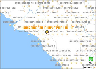
Kampong Solok Ayer Kelulut (Melaka, Malaysia)Kampong Solok Ayer Kelulut is a town in the Melaka region of Malaysia. An overview map of the region around Kampong Solok Ayer Kelulut is displayed below.
regional and 3d topo map of Kampong Solok Ayer Kelulut, Malaysia ::
Kampong Solok Ayer Kelulut airports ::
The nearest airport is MKZ - Malacca, located 19.4 km south east of Kampong Solok Ayer Kelulut.
Other airports nearby include KUL - Kuala Lumpur Intl (61.6 km north west), DUM - Dumai Pinang Kampai (110.5 km south west), JHB - Johor Bahru Sultan Ismail (191.4 km south east), KUA - Kuantan (200.1 km north east), Nearby towns ::
Kampong Sungai Baru Tengah (0.0km north) //
Kampong Londang (1.9km west) //
Kampong Solok Kemang (1.9km south) //
Kampong Paya Rumput (1.9km north) //
Solok Chambang (1.9km north) //
Kampong Tengah (1.9km north) //
Kampong Masjid Tanah (1.9km east) //
Masjid Tanah (1.9km east) //
Kampong Pulau (2.6km north west) //
Kampong Jeram (2.6km north west) //
Kampong Solok (2.6km south west) //
Kampong Solok Ayer Limau (2.6km north east) //
Solok Ayer Limau (2.6km north east) //
Kampong Lekok (2.6km north east) //
Paya Mengkuang (3.7km west) //
Kampong Ayer Hitam Ulu (3.7km south) //
Kampong Durian Daun (3.7km east) //
Kampong Solok Berangan (3.7km east) //
Solok Kayu Ara (3.7km east) //
Kampong Sungai Tuang (4.1km south west) //
Kampong Sungai Kertah (4.1km south west) //
Kampong Ujong Padang (4.1km north west) //
Kampong Solok Durian Daun (4.1km north east) //
Kampong Lubok Redan (5.2km north west) //
Kampong Hailam (5.2km south west) //
Kampong Padang Kemunting (5.2km south west) //
Pengkalan Balak (5.2km south west) //
Kampong Ayer Ponggai (5.2km north east) //
Kampong Telok Belanga (5.6km west) //
[all distances 'as the bird flies' and approximate] 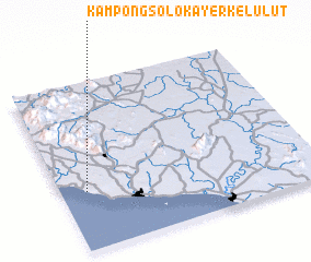 Places with similar names to Kampong Solok Ayer Kelulut, Malaysia ::
// Kampong Solok Ayer Kuning (MY)
Disclaimer :: Information on this page comes without warranty of any kind |
||
|
Where is Kampong Solok Ayer Kelulut? Elevation and coordinates ::
Latitude (lat): 2°21'0"N Longitude (lon): 102°6'0"E
Elevation (approx.): 35m (map arrows pan, magnifying glasses zoom) |
||
|
Visiting Kampong Solok Ayer Kelulut? Hotel/Accommodation ::
Book a hotel in Kampong Solok Ayer Kelulut Travel Guide ::
Buy a travel guide for Malaysia rental cars ::
car rental offers GPS waypoint ::
download a GPX waypoint (PoI) of Kampong Solok Ayer Kelulut for your GPS receiver
|
||