|
search place name
|
||
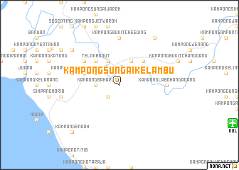
Kampong Sungai Kelambu (Malaysia)Kampong Sungai Kelambu is a town in Malaysia. An overview map of the region around Kampong Sungai Kelambu is displayed below.
regional and 3d topo map of Kampong Sungai Kelambu, Malaysia ::
Kampong Sungai Kelambu airports ::
The nearest airport is KUL - Kuala Lumpur Intl, located 18.8 km east of Kampong Sungai Kelambu.
Other airports nearby include MKZ - Malacca (98.0 km south east), DUM - Dumai Pinang Kampai (132.3 km south), IPH - Ipoh Sultan Azlan Shah (202.0 km north), KUA - Kuantan (213.6 km north east), Nearby towns ::
Kampong Sungai Lang (2.6km south west) //
Kampong Baharu (3.7km west) //
Teluk Datuk (4.1km north west) //
Kampung Sungai Manggis (4.1km north west) //
Kampong Baharu (4.1km north east) //
Telok Bunut (5.2km north west) //
Kampong Sungai Lempit (5.2km north east) //
Banting (5.9km west) //
Kampong Serdang Belah (6.7km north west) //
Kampong Labohan Dagang (7.4km east) //
Kampong Bukit Cheeding (7.4km north) //
Kampong Batu Enam (7.6km west) //
Pulau Kempas (9.3km north east) //
Buaya Sungai (9.3km north west) //
Kampong Endah (10.5km south west) //
[all distances 'as the bird flies' and approximate] 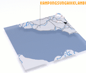 Places with similar names to Kampong Sungai Kelambu, Malaysia ::
// Kampong Sungai Kulim (MY)
Disclaimer :: Information on this page comes without warranty of any kind |
||
|
Where is Kampong Sungai Kelambu? Elevation and coordinates ::
Latitude (lat): 2°48'0"N Longitude (lon): 101°33'0"E
Elevation (approx.): 15m (map arrows pan, magnifying glasses zoom) |
||
|
Visiting Kampong Sungai Kelambu? Hotel/Accommodation ::
Book a hotel in Kampong Sungai Kelambu Travel Guide ::
Buy a travel guide for Malaysia rental cars ::
car rental offers GPS waypoint ::
download a GPX waypoint (PoI) of Kampong Sungai Kelambu for your GPS receiver
|
||