|
search place name
|
||
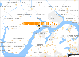
Kampong Sungai Melayu (Johor, Malaysia)Kampong Sungai Melayu is a town in the Johor region of Malaysia. An overview map of the region around Kampong Sungai Melayu is displayed below.
regional and 3d topo map of Kampong Sungai Melayu, Malaysia ::
Kampong Sungai Melayu airports ::
The nearest airport is XSP - Singapore Seletar, located 19.0 km east of Kampong Sungai Melayu.
Other airports nearby include JHB - Johor Bahru Sultan Ismail (21.4 km north), QPG - Paya Lebar (25.3 km south east), SIN - Singapore Changi Intl (34.6 km east), MKZ - Malacca (184.6 km north west), Nearby towns ::
Lim Chu Kang (1.8km south east) //
Namazie Estate (3.2km south) //
Thong Hoe Village (3.6km south) //
Ng Kay Boon Estate (3.7km east) //
Tambatan (3.7km east) //
Tampoi (3.7km north) //
Kampong Tarom (4.1km north east) //
Kampong Jawa (4.1km north east) //
Kampong Sekudai (4.1km north east) //
Kampong Baharu (4.1km north east) //
Kampong Tebing Runtoh (4.1km south west) //
Tan Hua Gek Estate (4.6km south) //
Lim Chu Kang Estate (4.7km south west) //
Ama Keng (5.1km south) //
Kampong Pasir (5.6km north) //
Johor Bahru (5.9km east) //
Kampong Nong Chik (5.9km east) //
Kampong Telok Serdang (5.9km north) //
Larkin (6.7km north east) //
Aik Hong and Aik Chiang Estate (7.3km south east) //
Kampong Mandai Kechil (7.3km east) //
Bukit Mandai Village (7.6km south east) //
Marsiling Estate (7.8km east) //
Teck Chong Estate (7.9km south east) //
Kampong Kebun Teh (7.9km north east) //
Kampong Baharu (7.9km south west) //
Marsiling (7.9km east) //
Woodlands New Town (8.5km east) //
Kampong Cutforth (8.6km south east) //
[all distances 'as the bird flies' and approximate]  Places with similar names to Kampong Sungai Melayu, Malaysia :: Disclaimer :: Information on this page comes without warranty of any kind |
||
|
Where is Kampong Sungai Melayu? Elevation and coordinates ::
Latitude (lat): 1°27'0"N Longitude (lon): 103°42'0"E
Elevation (approx.): -32768m (map arrows pan, magnifying glasses zoom) |
||
|
Visiting Kampong Sungai Melayu? Hotel/Accommodation ::
Book a hotel in Kampong Sungai Melayu Travel Guide ::
Buy a travel guide for Malaysia rental cars ::
car rental offers GPS waypoint ::
download a GPX waypoint (PoI) of Kampong Sungai Melayu for your GPS receiver
|
||