|
search place name
|
||
Kampong Sungai Rambutan (Perak, Malaysia)Kampong Sungai Rambutan is a town in the Perak region of Malaysia. An overview map of the region around Kampong Sungai Rambutan is displayed below.
regional and 3d topo map of Kampong Sungai Rambutan, Malaysia ::

Kampong Sungai Rambutan airports ::
The nearest airport is PEN - Penang Intl, located 54.4 km west of Kampong Sungai Rambutan.
Other airports nearby include IPH - Ipoh Sultan Azlan Shah (85.3 km south east), AOR - Alor Setar Sultan Abdul Halim (109.9 km north), LGK - Pulau Langkawi Intl (164.4 km north west), PAN - Pattani (173.3 km north), Nearby towns ::
Kampong Tanjong Rengkong (1.9km north) //
Kampong Nor (1.9km south) //
Kampong Sungai Setar (2.6km north east) //
Kampong Gobek (2.6km south east) //
Sungai Bayur (2.6km south east) //
Kampong Damak (2.6km south east) //
Kampong Sungai Sentang (2.6km north west) //
Kampong Kuala Enau (2.6km south west) //
Kampong Banggol Jas (2.6km south west) //
Kampong Bukit Enau (2.6km south west) //
Kampong Bedarah (3.7km east) //
Kampong Garok (3.7km east) //
Kampong Banggol Durian (3.7km west) //
Kampong Ulu Sungai Rambutan (4.1km north east) //
Kampong Rantau Panjang Ulu Kerian (4.1km north west) //
Kampong Sungai Taka (4.1km north west) //
Kampong Mesjid (4.1km south west) //
Kampong Rantau Panjang (5.2km north west) //
Kampong Tengah (5.2km south west) //
Rantau Panjang (5.2km south west) //
Kampung Lubuk Buaya (5.5km east) //
Kampong Bagan Jermai (5.5km west) //
Kampong Ulu Kerian (5.6km north) //
Kampong Tebing Tinggi (5.6km south) //
Kampong Ulu Mengkuang (5.6km south) //
Kampong Bukit Kubor (5.6km north) //
Kampong Tasek (5.8km west) //
Kampong Rimba Setali (5.8km west) //
Kampong Batu Tiga (5.8km west) //
[all distances 'as the bird flies' and approximate] 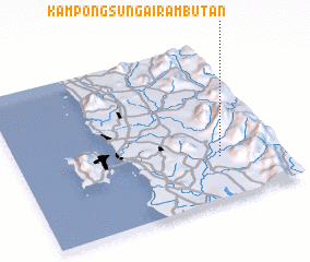 Places with similar names to Kampong Sungai Rambutan, Malaysia :: Disclaimer :: Information on this page comes without warranty of any kind |
||
|
Where is Kampong Sungai Rambutan? Elevation and coordinates ::
Latitude (lat): 5°16'0"N Longitude (lon): 100°46'0"E
Elevation (approx.): 40m (map arrows pan, magnifying glasses zoom) |
||
|
Visiting Kampong Sungai Rambutan? Hotel/Accommodation ::
Book a hotel in Kampong Sungai Rambutan Travel Guide ::
Buy a travel guide for Malaysia rental cars ::
car rental offers GPS waypoint ::
download a GPX waypoint (PoI) of Kampong Sungai Rambutan for your GPS receiver
|
||