|
search place name
|
||
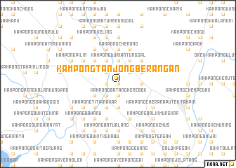
Kampong Tanjong Berangan (Negeri Sembilan, Malaysia)Kampong Tanjong Berangan is a town in the Negeri Sembilan region of Malaysia. An overview map of the region around Kampong Tanjong Berangan is displayed below.
regional and 3d topo map of Kampong Tanjong Berangan, Malaysia ::
Kampong Tanjong Berangan airports ::
The nearest airport is MKZ - Malacca, located 29.3 km south east of Kampong Tanjong Berangan.
Other airports nearby include KUL - Kuala Lumpur Intl (54.4 km north west), DUM - Dumai Pinang Kampai (125.6 km south west), KUA - Kuantan (184.9 km north east), JHB - Johor Bahru Sultan Ismail (195.5 km south east), Nearby towns ::
Kampong Agam (NaNkm north) //
Kampong Seri Melenggang (NaNkm north) //
Kampong Ayer Melintang (1.9km west) //
Kampong Istana Raja (1.9km west) //
Kampong Padang (1.9km west) //
Kampong Tanjong (1.9km north) //
Kampong Paya Kumoh (1.9km north) //
Kampong Batang Merebok (1.9km south) //
Kampong Perigi Berangan (2.6km north west) //
Kampong Semerbok (2.6km south west) //
Kampong Tengah Penajis (2.6km north west) //
Kampong Gonggong (2.6km north west) //
Kampong Bukit Keledang (2.6km north east) //
Kampong Sungai Serai (3.7km south) //
Kampong Durian Tunggal (3.7km north) //
Kampong Kendong (3.7km east) //
Kampong Perigi Batu (4.1km north west) //
Kampong Ampangan (4.1km north west) //
Kampong Penajis (4.1km north west) //
Kampong Bukit Jelutong (4.1km south west) //
Kampong Relong (4.1km north west) //
Kampong Nerasau (4.1km north west) //
Bangsal Batu (4.1km north east) //
Kampong Tiga Batu (4.1km south west) //
Kampong Sawah Rajah (4.1km south west) //
Kampong Kota (4.1km north east) //
Kampong Gadong (4.1km north east) //
Kampong Perah (4.1km north east) //
Kota (4.1km north east) //
[all distances 'as the bird flies' and approximate] 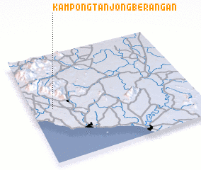 Places with similar names to Kampong Tanjong Berangan, Malaysia ::
// Kampong Tanjong Baharu (MY)
// Kampong Tanjong Bako (MY)
// Kampong Tanjong Balai (MY)
// Kampong Tanjong Balang (MY)
// Kampong Tanjong Batu (MY)
// Kampong Tanjong Batu (MY)
// Kampong Tanjong Batu (MY)
// Kampong Tanjong Batu (MY)
// Kampong Tanjong Batu (MY)
// Kampong Tanjong Batu (MY)
Disclaimer :: Information on this page comes without warranty of any kind |
||
|
Where is Kampong Tanjong Berangan? Elevation and coordinates ::
Latitude (lat): 2°30'0"N Longitude (lon): 102°8'0"E
Elevation (approx.): 37m (map arrows pan, magnifying glasses zoom) |
||
|
Visiting Kampong Tanjong Berangan? Hotel/Accommodation ::
Book a hotel in Kampong Tanjong Berangan Travel Guide ::
Buy a travel guide for Malaysia rental cars ::
car rental offers GPS waypoint ::
download a GPX waypoint (PoI) of Kampong Tanjong Berangan for your GPS receiver
|
||