|
search place name
|
||
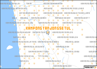
Kampong Tanjong Setul (Kedah, Malaysia)Kampong Tanjong Setul is a town in the Kedah region of Malaysia. An overview map of the region around Kampong Tanjong Setul is displayed below.
regional and 3d topo map of Kampong Tanjong Setul, Malaysia ::
Kampong Tanjong Setul airports ::
The nearest airport is AOR - Alor Setar Sultan Abdul Halim, located 31.1 km north of Kampong Tanjong Setul.
Other airports nearby include PEN - Penang Intl (71.7 km south), LGK - Pulau Langkawi Intl (93.6 km north west), HDY - Songkhla Hat Yai Intl (112.7 km north), PAN - Pattani (122.5 km north east), Nearby towns ::
Kampong Banggol (1.8km east) //
Bukij Jenun (1.9km south) //
Kampong Sungai Durian (2.6km north east) //
Kelang Kechil (2.6km north east) //
Kampong Bukit Pinang (2.6km north west) //
Tok Chin Tong (2.6km south west) //
Kampong Bukit Jambul (3.7km north) //
Kampong Paya Sena (3.7km north) //
Kampong Kubang Kuar (3.7km north) //
Kampong Sungai Baru (3.7km south) //
Kampong Padang Lumat (3.7km west) //
Simpang Tiga (3.7km west) //
Kampong Manggol Tambak (4.1km north east) //
Kampong Paya Kerchut (4.1km north east) //
Kampong Ayer Puteh (4.1km north east) //
Kampong Bukit Chepat (4.1km north west) //
Kampong Alor Nan (4.1km north west) //
Kampong Duhit (4.1km south east) //
Kampong Pulau Emas (4.1km north west) //
Kampong Padang Besar (4.1km north west) //
Kampong Kubang Kuar (5.2km north east) //
Kampong Paya Kerchut (5.2km north east) //
Kampong Pokok Tai (5.2km south east) //
Kampong Banggol Tengah (5.2km south east) //
Kampong Paya Palas (5.5km east) //
Kampong Paya Saga (5.6km north) //
Kampong Pondok (5.6km south) //
Guar Chempedak (5.6km south) //
Kampong Titi Bom (5.6km south) //
[all distances 'as the bird flies' and approximate] 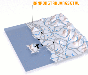 Places with similar names to Kampong Tanjong Setul, Malaysia ::
// Kampong Tanjong Asam (MY)
// Kampong Tanjong Sari (MY)
// Kampong Tanjong Seberang (MY)
// Kampong Tanjong Selabu (MY)
// Kampong Tanjong Semberong (MY)
// Kampong Tanjong Sena (MY)
// Kampong Tanjong Sena (MY)
// Kampong Tanjong Sentang (MY)
// Kampong Tanjong Serai (MY)
// Kampong Tanjong Serindet (MY)
Disclaimer :: Information on this page comes without warranty of any kind |
||
|
Where is Kampong Tanjong Setul? Elevation and coordinates ::
Latitude (lat): 5°55'0"N Longitude (lon): 100°28'0"E
Elevation (approx.): 8m (map arrows pan, magnifying glasses zoom) |
||
|
Visiting Kampong Tanjong Setul? Hotel/Accommodation ::
Book a hotel in Kampong Tanjong Setul Travel Guide ::
Buy a travel guide for Malaysia rental cars ::
car rental offers GPS waypoint ::
download a GPX waypoint (PoI) of Kampong Tanjong Setul for your GPS receiver
|
||