|
search place name
|
||
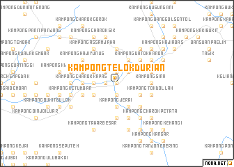
Kampong Telok Durian (Kedah, Malaysia)Kampong Telok Durian is a town in the Kedah region of Malaysia. An overview map of the region around Kampong Telok Durian is displayed below.
regional and 3d topo map of Kampong Telok Durian, Malaysia ::
Kampong Telok Durian airports ::
The nearest airport is PEN - Penang Intl, located 73.6 km south west of Kampong Telok Durian.
Other airports nearby include AOR - Alor Setar Sultan Abdul Halim (79.3 km north west), IPH - Ipoh Sultan Azlan Shah (120.8 km south), PAN - Pattani (131.8 km north), NAW - Narathiwat (139.3 km north east), Nearby towns ::
Kampung Kupang (0.0km north) //
Kampong Tanjong Merbau (1.9km south) //
Kampong Landak (1.8km west) //
Kampong Tanah Periok (1.8km west) //
Kampong Lela (1.8km west) //
Kampong Chenerai (1.8km west) //
Kampong Charok Bemban (1.9km north) //
Kampong Gua Raban (1.9km north) //
Kampong Kubang Panjang (1.9km north) //
Kampong Padang China (2.6km north west) //
Kampong Terbak (2.6km north east) //
Kampong Lubok Kabu (3.7km west) //
Kampong Hangus (3.7km south) //
Kampong Tanjong (3.7km south) //
Kampong Pisang (3.7km south) //
Kampong Jerai (3.7km south) //
Kampong Telok Perah (4.1km south west) //
Kampong Rambong (4.1km south east) //
Kuala Pegang (4.1km north west) //
Kampong Tiak (4.1km south east) //
Kampong Charok Rambai (4.1km south east) //
Kampong Pak Bong (4.1km south east) //
Kampong Lubok Batu (4.1km north east) //
Kampong Charok Kangkar (5.2km south east) //
Kampong Datok (5.2km north east) //
Kampong Datok Haron (5.2km north east) //
Kampong Pauh Besar (5.2km north east) //
Kampong To Saban (5.2km north east) //
Kampong Charok Kapas (5.5km west) //
[all distances 'as the bird flies' and approximate]  Places with similar names to Kampong Telok Durian, Malaysia :: Disclaimer :: Information on this page comes without warranty of any kind |
||
|
Where is Kampong Telok Durian? Elevation and coordinates ::
Latitude (lat): 5°38'0"N Longitude (lon): 100°51'0"E
Elevation (approx.): 63m (map arrows pan, magnifying glasses zoom) |
||
|
Visiting Kampong Telok Durian? Hotel/Accommodation ::
Book a hotel in Kampong Telok Durian Travel Guide ::
Buy a travel guide for Malaysia rental cars ::
car rental offers GPS waypoint ::
download a GPX waypoint (PoI) of Kampong Telok Durian for your GPS receiver
|
||