|
search place name
|
||
Kampong Temin (Perak, Malaysia)Kampong Temin is a town in the Perak region of Malaysia. An overview map of the region around Kampong Temin is displayed below.
regional and 3d topo map of Kampong Temin, Malaysia ::

Kampong Temin airports ::
The nearest airport is IPH - Ipoh Sultan Azlan Shah, located 33.7 km south of Kampong Temin.
Other airports nearby include PEN - Penang Intl (96.4 km north west), AOR - Alor Setar Sultan Abdul Halim (162.4 km north west), NAW - Narathiwat (199.0 km north east), KBR - Kota Bahru Sultan Ismail Petra (200.4 km north east), Nearby towns ::
Kampong Bertai (1.9km north) //
Kampong Tanjong Terosor (2.6km north west) //
Kampong Suak Plang (2.6km south east) //
Kampong Tok Punggoh (3.7km west) //
Kampong Keramat Dusun Tok Bayas (3.7km north) //
Kampong Pulau Mentimum (3.7km north) //
Kampong Kelemat (3.7km north) //
Kampong Kuala Pelus (4.1km north west) //
Kampong Pulau Kemiri (5.2km north west) //
Kampong Suak Pelong (5.2km north west) //
Kampong Pasir Kandang (5.8km west) //
Kampong Jawang (5.8km west) //
Kampong Prek Tengah (5.8km west) //
Kampong Prek Dalam (5.8km west) //
Kampong Mor (5.9km north) //
Kampong Batu Tiga (5.8km east) //
Kampong Setia (6.7km south west) //
Sungai Siput (6.7km south east) //
Kampong Batu Jarau (7.6km west) //
Kampong Loh (7.6km west) //
Karai (7.6km west) //
Kampong Lambok (7.8km north west) //
Kampong Pasir Sudu (7.8km north west) //
Kampong Labu Kubong (7.8km north west) //
Kampong Teropok (8.3km north west) //
Kampong Tahan (8.3km north west) //
Kampong Kuala Poh (8.3km north west) //
Kampong Chegar Galah (8.3km north west) //
Kampong Lembah Jamuan (8.3km south west) //
[all distances 'as the bird flies' and approximate] 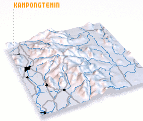 Places with similar names to Kampong Temin, Malaysia ::
// Kampong Taman (MY)
// Kampong Tambun (MY)
// Kampong Temin (MY)
// Kampong Tuman (MY)
// Kampung Taman (MY)
// Kampung Tambun (MY)
Disclaimer :: Information on this page comes without warranty of any kind |
||
|
Where is Kampong Temin? Elevation and coordinates ::
Latitude (lat): 4°52'0"N Longitude (lon): 101°2'0"E
Elevation (approx.): 71m (map arrows pan, magnifying glasses zoom) |
||
|
Visiting Kampong Temin? Hotel/Accommodation ::
Book a hotel in Kampong Temin Travel Guide ::
Buy a travel guide for Malaysia rental cars ::
car rental offers GPS waypoint ::
download a GPX waypoint (PoI) of Kampong Temin for your GPS receiver
|
||