|
search place name
|
||
Kampong Tengah (Melaka, Malaysia)Kampong Tengah is a town in the Melaka region of Malaysia. An overview map of the region around Kampong Tengah is displayed below.
regional and 3d topo map of Kampong Tengah, Malaysia ::

Kampong Tengah airports ::
The nearest airport is MKZ - Malacca, located 18.6 km south east of Kampong Tengah.
Other airports nearby include KUL - Kuala Lumpur Intl (64.0 km north west), DUM - Dumai Pinang Kampai (122.2 km south west), JHB - Johor Bahru Sultan Ismail (186.3 km south east), KUA - Kuantan (188.6 km north east), Nearby towns ::
Kampong Padang (0.0km north) //
Kampong Tanjong Balai (0.0km north) //
Kampong Kemus (1.9km north) //
Kampong Lubok Kepong (1.9km north) //
Kampong Kundangan (1.9km north) //
Kampong Pereling (1.9km north) //
Simpang Empat (1.9km north) //
Kampong Paya Dalam (1.9km west) //
Kampong Sungai Ragok (1.9km south) //
Kampong Batang Melekek (1.9km east) //
Kampong Ulu Sungai Buloh (2.6km north west) //
Kampong Sungai Buloh (2.6km north west) //
Kampong Lanjut Manis (2.6km south west) //
Kampong Masjid Saga (2.6km south west) //
Kampong Paya Datok (2.6km south east) //
Kampong Alor Gajah (2.6km south east) //
Padang Kambing (3.7km west) //
Kampong Padang Besar (3.7km west) //
Kampong Kuala Kati (3.7km west) //
Kampong Balik Mungkar (3.7km north) //
Kampong Taboh (3.7km north) //
Kampong Naning (3.7km north) //
Kampong Ayer Lanjut (3.7km south) //
Kampong Ulu Pegoh (3.7km east) //
Kampong Gedang (4.1km south west) //
Kampong Lanjut Manis (4.1km south west) //
Kampong Lelong (4.1km south west) //
Kampong Ayer Pa'abas (4.1km south west) //
Kampong Padang Lalang (4.1km south west) //
[all distances 'as the bird flies' and approximate] 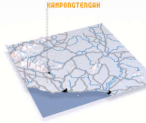 Places with similar names to Kampong Tengah, Malaysia ::
// Kampong Tangah (MY)
// Kampong Tanggai (MY)
// Kampong Teng (MY)
// Kampong Tengah (MY)
// Kampong Tengah (MY)
// Kampong Tengah (MY)
// Kampong Tengah (MY)
// Kampong Tengah (MY)
// Kampong Tengah (MY)
// Kampong Tengah (MY)
Disclaimer :: Information on this page comes without warranty of any kind |
||
|
Where is Kampong Tengah? Elevation and coordinates ::
Latitude (lat): 2°25'0"N Longitude (lon): 102°11'0"E
Elevation (approx.): 30m (map arrows pan, magnifying glasses zoom) |
||
|
Visiting Kampong Tengah? Hotel/Accommodation ::
Book a hotel in Kampong Tengah Travel Guide ::
Buy a travel guide for Malaysia rental cars ::
car rental offers GPS waypoint ::
download a GPX waypoint (PoI) of Kampong Tengah for your GPS receiver
|
||