|
search place name
|
||
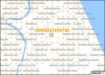
Kampong Teratak (Kelantan, Malaysia)Kampong Teratak is a town in the Kelantan region of Malaysia. An overview map of the region around Kampong Teratak is displayed below.
regional and 3d topo map of Kampong Teratak, Malaysia ::
Kampong Teratak airports ::
The nearest airport is KBR - Kota Bahru Sultan Ismail Petra, located 20.3 km north of Kampong Teratak.
Other airports nearby include NAW - Narathiwat (85.5 km north west), TGG - Kuala Terengganu Sultan Mahmud (111.1 km south east), PAN - Pattani (154.8 km north west), KTE - Kerteh (202.9 km south east), Nearby towns ::
Kampong Jambu Merah (0.0km north) //
Kampong Kubang Bongor (0.0km north) //
Kampong Melor (0.0km north) //
Kampong Maligai (1.9km south) //
Melur (1.9km south) //
Kampong Kubidar (1.9km north) //
Kampong Bechah Keranji (1.9km north) //
Kampong Bemban (1.9km north) //
Kampong Jambu Merah (1.8km west) //
Kampong Padang Leban (1.8km west) //
Kampong Hutan Kubor (1.8km east) //
Kampong Tegayong (1.8km east) //
Kampong Tok Perang (2.6km south west) //
Kampong Simpang Tiga Tegayong (2.6km south east) //
Kampong Alor Bakat (2.6km south east) //
Kampong Aril (2.6km north east) //
Kampong Pangkal Pisang (2.6km north west) //
Kampong Kubang Idan (2.6km north east) //
Kampong Bechah Mulong (2.6km north east) //
Kampong Hangus (3.7km west) //
Kampong Kedondong (3.7km west) //
Kampong Mak Kuja (3.7km south) //
Kampong Bukit Hanyut (3.7km east) //
Kampong Permatang Pusu (3.7km east) //
Kampong Tembesu (3.7km north) //
Kampong Parit (3.7km north) //
Kampong Lachang (4.1km south west) //
Kampong Lintah (4.1km south west) //
Kampong Tok Mat (4.1km south west) //
[all distances 'as the bird flies' and approximate]  Places with similar names to Kampong Teratak, Malaysia :: Disclaimer :: Information on this page comes without warranty of any kind |
||
|
Where is Kampong Teratak? Elevation and coordinates ::
Latitude (lat): 5°59'0"N Longitude (lon): 102°18'0"E
Elevation (approx.): 10m (map arrows pan, magnifying glasses zoom) |
||
|
Visiting Kampong Teratak? Hotel/Accommodation ::
Book a hotel in Kampong Teratak Travel Guide ::
Buy a travel guide for Malaysia rental cars ::
car rental offers GPS waypoint ::
download a GPX waypoint (PoI) of Kampong Teratak for your GPS receiver
|
||