|
search place name
|
||
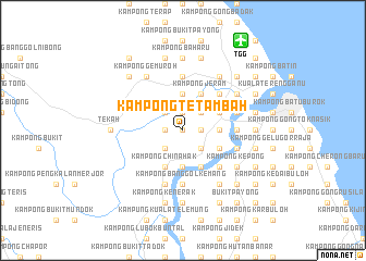
Kampong Tetambah (Terengganu, Malaysia)Kampong Tetambah is a town in the Terengganu region of Malaysia. An overview map of the region around Kampong Tetambah is displayed below.
regional and 3d topo map of Kampong Tetambah, Malaysia ::
Kampong Tetambah airports ::
The nearest airport is TGG - Kuala Terengganu Sultan Mahmud, located 10.9 km north east of Kampong Tetambah.
Other airports nearby include KTE - Kerteh (94.1 km south east), KBR - Kota Bahru Sultan Ismail Petra (127.4 km north west), KUA - Kuantan (169.5 km south), NAW - Narathiwat (197.8 km north west), Nearby towns ::
Kampong Kubor Besar (0.0km north) //
Kampong Banggol Peradong (1.9km north) //
Kampong Bukit Guntong (1.9km north) //
Kampong Baharu (1.9km north) //
Kampong Kubor (1.9km north) //
Kampong Tualang (1.8km east) //
Kampong Bukit Betiti (1.8km west) //
Kampong Kesom (1.8km west) //
Kampong Dusun Pinang (1.8km west) //
Kampong Tok Harun (1.8km east) //
Kampong Durian Emas (1.8km east) //
Kampong Kebor Ayer (2.6km north east) //
Kampong Padang Machang (2.6km south east) //
Kampong Dusun Melintang (2.6km south west) //
Kampong Belara (2.6km north west) //
Kampong Belu Sindor (2.6km south west) //
Kampong Tok Mat (2.6km south west) //
Kampong Peradong (3.7km south) //
Kampong Pengkalan Gelugor (3.7km north) //
Kampong Pasir Tebakang (3.7km east) //
Kampong China Hak (4.1km south west) //
Kampong Batu Hampar (4.1km south west) //
Kampung Pulau Babi (4.1km south east) //
Kampong Jeram (4.1km north east) //
Kampong Beladau Kolam (4.1km south east) //
Kampung Manir (4.1km north east) //
Kampong Banggol Tuan Muda (4.1km north east) //
Kampong Buloh Gading (5.2km north east) //
Kampong Selat Beladau (5.2km south east) //
[all distances 'as the bird flies' and approximate] 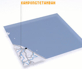 Places with similar names to Kampong Tetambah, Malaysia :: Disclaimer :: Information on this page comes without warranty of any kind |
||
|
Where is Kampong Tetambah? Elevation and coordinates ::
Latitude (lat): 5°18'0"N Longitude (lon): 103°3'0"E
Elevation (approx.): 4m (map arrows pan, magnifying glasses zoom) |
||
|
Visiting Kampong Tetambah? Hotel/Accommodation ::
Book a hotel in Kampong Tetambah Travel Guide ::
Buy a travel guide for Malaysia rental cars ::
car rental offers GPS waypoint ::
download a GPX waypoint (PoI) of Kampong Tetambah for your GPS receiver
|
||