|
search place name
|
||
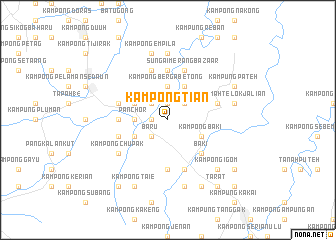
Kampong Tian (Sarawak, Malaysia)Kampong Tian is a town in the Sarawak region of Malaysia. An overview map of the region around Kampong Tian is displayed below.
regional and 3d topo map of Kampong Tian, Malaysia ::
Kampong Tian airports ::
The nearest airport is KCH - Kuching Intl, located 28.5 km north west of Kampong Tian.
Other airports nearby include SQC - Sintang Susilo (172.7 km south east), PNK - Pontianak Supadio (197.5 km south west), SBW - Sibu (200.1 km north east), Nearby towns ::
Kampong Baharu (1.9km west) //
Palah Bazaar (1.9km north) //
Kampong Betong (2.6km north west) //
Kampong Bintawa (2.6km north west) //
Baru (2.6km south west) //
Kampong Murut (2.6km north east) //
Panchor (3.7km west) //
Kampong Berga Betong (3.7km north) //
Kampung Ritoh Palah (4.1km north west) //
Kampong Panchor (4.1km south west) //
Kampong Seginam (4.1km north east) //
Kampong Baki (4.1km south east) //
Baki (5.2km south east) //
Pelaman Baki (5.2km south east) //
Kampong Sekeduk (5.6km west) //
Kampong Ulu Merang (5.6km north) //
Kampong Seruit (5.6km north) //
Kampong Turong (5.6km north) //
Kampong Baharu (5.6km south) //
Twenty-Fourth Mile Bazaar (5.9km west) //
Kampung Menaul (5.9km east) //
Kampong Merang (5.9km north) //
Kampong Payang (5.9km west) //
Kampong Munggu Lalang (5.9km south) //
Kampong Bunga (5.9km south) //
Sungai Merang Bazaar (5.9km north) //
Kampong Chupak (6.7km south west) //
Kampong Soh (7.4km north) //
Kampong Raeh (7.4km north) //
[all distances 'as the bird flies' and approximate] 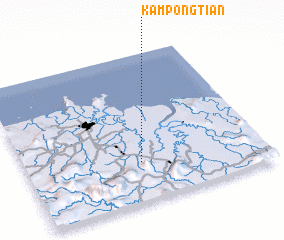 Places with similar names to Kampong Tian, Malaysia ::
// Kampung Tian (MY)
// Kampong Chanae (TH)
// Kampong Chaain (MY)
// Kampong Chain (MY)
// Kampong Changhai (MY)
// Kampong Cheniah (MY)
// Kampong Chenua (MY)
// Kampong Chin (MY)
// Kampong China (MY)
// Kampong China (MY)
Disclaimer :: Information on this page comes without warranty of any kind |
||
|
Where is Kampong Tian? Elevation and coordinates ::
Latitude (lat): 1°16'0"N Longitude (lon): 110°29'0"E
Elevation (approx.): 10m (map arrows pan, magnifying glasses zoom) |
||
|
Visiting Kampong Tian? Hotel/Accommodation ::
Book a hotel in Kampong Tian Travel Guide ::
Buy a travel guide for Malaysia rental cars ::
car rental offers GPS waypoint ::
download a GPX waypoint (PoI) of Kampong Tian for your GPS receiver
|
||