|
search place name
|
||
Kampong Tok Derpah (Kelantan, Malaysia)Kampong Tok Derpah is a town in the Kelantan region of Malaysia. An overview map of the region around Kampong Tok Derpah is displayed below.
regional and 3d topo map of Kampong Tok Derpah, Malaysia ::

Kampong Tok Derpah airports ::
The nearest airport is KBR - Kota Bahru Sultan Ismail Petra, located 27.5 km north east of Kampong Tok Derpah.
Other airports nearby include NAW - Narathiwat (65.7 km north west), PAN - Pattani (132.3 km north west), TGG - Kuala Terengganu Sultan Mahmud (134.0 km south east), AOR - Alor Setar Sultan Abdul Halim (187.3 km west), Nearby towns ::
Kampong Terisik (0.0km north) //
Kampong Merbal (1.9km south) //
Kampong Lubok Batil (1.8km west) //
Kampong Binjai (1.8km west) //
Kampong Tiong Chandi (1.8km east) //
Kampong Tasek Berangan (1.8km east) //
Kampong Kejing (1.8km east) //
Kampong Repek (1.8km east) //
Kampong Banggol Setol (1.9km north) //
Kampong Gebeng (1.9km north) //
Kampong Serungga (2.6km south west) //
Kampong Taman (2.6km south east) //
Ketek Terisik (2.6km south east) //
Kampong Tok Sangkot (2.6km north west) //
Kampong Lubok Kawah (2.6km north west) //
Kampong Banggol Ara (2.6km north east) //
Kampong Kiat (3.7km east) //
Kampong Gaung (3.7km east) //
Kampong Banggol Tempoyak (3.7km north) //
Kampong Alor Pasir (3.7km north) //
Kampong Pohon Tanjong (3.7km north) //
Kampong Pusu Empat Puloh (4.1km south east) //
Kampong Jejawi (4.1km north west) //
Kampong Banggol Nyior (4.1km north west) //
Kampong Banggol (4.1km north west) //
Kampong Chenderai (4.1km north west) //
Kampong Kepas (4.1km south east) //
Kampong Berangan (4.1km south east) //
Kampong Lati (4.1km south east) //
[all distances 'as the bird flies' and approximate] 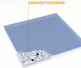 Places with similar names to Kampong Tok Derpah, Malaysia :: Disclaimer :: Information on this page comes without warranty of any kind |
||
|
Where is Kampong Tok Derpah? Elevation and coordinates ::
Latitude (lat): 6°2'0"N Longitude (lon): 102°5'0"E
Elevation (approx.): 9m (map arrows pan, magnifying glasses zoom) |
||
|
Visiting Kampong Tok Derpah? Hotel/Accommodation ::
Book a hotel in Kampong Tok Derpah Travel Guide ::
Buy a travel guide for Malaysia rental cars ::
car rental offers GPS waypoint ::
download a GPX waypoint (PoI) of Kampong Tok Derpah for your GPS receiver
|
||