|
search place name
|
||
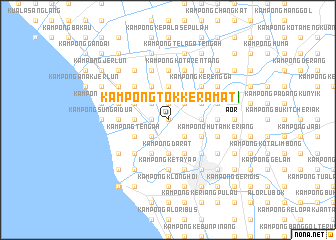
Kampong Tok Keramat (Kedah, Malaysia)Kampong Tok Keramat is a town in the Kedah region of Malaysia. An overview map of the region around Kampong Tok Keramat is displayed below.
regional and 3d topo map of Kampong Tok Keramat, Malaysia ::
Kampong Tok Keramat airports ::
The nearest airport is AOR - Alor Setar Sultan Abdul Halim, located 7.6 km east of Kampong Tok Keramat.
Other airports nearby include LGK - Pulau Langkawi Intl (69.3 km west), HDY - Songkhla Hat Yai Intl (85.0 km north), PEN - Penang Intl (96.4 km south), PAN - Pattani (113.6 km north east), Nearby towns ::
Kampong Sungai Baharu Tengah (0.0km north) //
Kampong Padang (0.0km north) //
Kampong Gunong Hilir (1.9km north) //
Kampong Gunong Ulu (1.9km north) //
Kampong Padang Lalang (1.8km west) //
Kampong Gelam (1.8km west) //
Kampung Permatang Gunong (2.6km north west) //
Kampung Sungai Baharu Gunong (2.6km north east) //
Kampong Alor Gunchar (2.6km north east) //
Kampong Sungai Baru (2.6km north east) //
Kampong Kuala Sungai (2.6km south west) //
Kampong Pisang (2.6km south east) //
Kampong Telok Binasa (3.7km north) //
Kampong Kuar Jawa (3.7km west) //
Kampong Kubang Bongor (3.7km west) //
Kampung Alur Janggus (3.7km west) //
Kampong Pantai Johor (3.7km east) //
Kampong Suka Menanti (3.7km east) //
Kampong Mergong (3.7km south) //
Kampong Darat (3.7km south) //
Kampong Tambun Tulang (3.7km south) //
Kampong Hutan (4.1km north west) //
Kampung Padang Gunong (4.1km north west) //
Kampong Simpang Empat Kuar (4.1km north west) //
Kubang Siam (4.1km north west) //
Kampong Kubang Jambu (4.1km south west) //
Kampong Tengah (4.1km south west) //
Kampong Alor Madi (4.1km north east) //
Kampong Alor Melintang (4.1km north east) //
[all distances 'as the bird flies' and approximate] 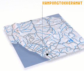 Places with similar names to Kampong Tok Keramat, Malaysia :: Disclaimer :: Information on this page comes without warranty of any kind |
||
|
Where is Kampong Tok Keramat? Elevation and coordinates ::
Latitude (lat): 6°10'0"N Longitude (lon): 100°20'0"E
Elevation (approx.): 7m (map arrows pan, magnifying glasses zoom) |
||
|
Visiting Kampong Tok Keramat? Hotel/Accommodation ::
Book a hotel in Kampong Tok Keramat Travel Guide ::
Buy a travel guide for Malaysia rental cars ::
car rental offers GPS waypoint ::
download a GPX waypoint (PoI) of Kampong Tok Keramat for your GPS receiver
|
||