|
search place name
|
||
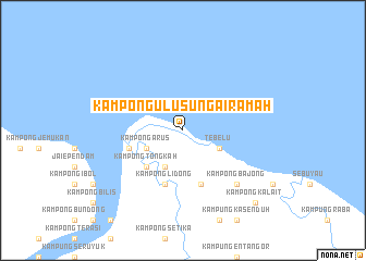
Kampong Ulu Sungai Ramah (Sarawak, Malaysia)Kampong Ulu Sungai Ramah is a town in the Sarawak region of Malaysia. An overview map of the region around Kampong Ulu Sungai Ramah is displayed below.
regional and 3d topo map of Kampong Ulu Sungai Ramah, Malaysia ::
Kampong Ulu Sungai Ramah airports ::
The nearest airport is KCH - Kuching Intl, located 53.1 km west of Kampong Ulu Sungai Ramah.
Other airports nearby include SBW - Sibu (151.0 km north east), SQC - Sintang Susilo (181.6 km south east), PNK - Pontianak Supadio (246.6 km south west), Nearby towns ::
Tebelu (4.1km south east) //
Kampong Sungai Tebelu (4.1km south east) //
Kampong Sekitong (4.1km south west) //
Kampong Arus (4.1km south west) //
Kampong Tongkah (5.2km south west) //
Kampong Mansika (5.9km south) //
Sebangan (5.9km west) //
Kampong Sebangan (5.9km west) //
Kampong Lidong (5.9km south) //
Kampong Bajong (7.9km south east) //
Kampong Jaragam (10.5km south east) //
Kampong Kalait (10.5km south east) //
[all distances 'as the bird flies' and approximate] 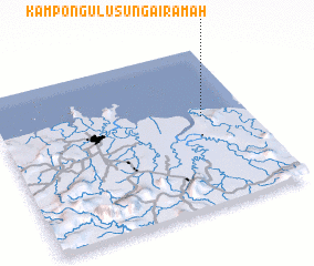 Places with similar names to Kampong Ulu Sungai Ramah, Malaysia ::
// Kampong Ulu Sungai Rambutan (MY)
Disclaimer :: Information on this page comes without warranty of any kind |
||
|
Where is Kampong Ulu Sungai Ramah? Elevation and coordinates ::
Latitude (lat): 1°34'0"N Longitude (lon): 110°49'0"E
Elevation (approx.): 3m (map arrows pan, magnifying glasses zoom) |
||
|
Visiting Kampong Ulu Sungai Ramah? Hotel/Accommodation ::
Book a hotel in Kampong Ulu Sungai Ramah Travel Guide ::
Buy a travel guide for Malaysia rental cars ::
car rental offers GPS waypoint ::
download a GPX waypoint (PoI) of Kampong Ulu Sungai Ramah for your GPS receiver
|
||