|
search place name
|
||
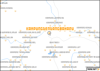
Kampung Dendang Baharu (Malaysia)Kampung Dendang Baharu is a town in Malaysia. An overview map of the region around Kampung Dendang Baharu is displayed below.
regional and 3d topo map of Kampung Dendang Baharu, Malaysia ::
Kampung Dendang Baharu airports ::
The nearest airport is KTE - Kerteh, located 39.7 km south east of Kampung Dendang Baharu.
Other airports nearby include TGG - Kuala Terengganu Sultan Mahmud (65.0 km north), KUA - Kuantan (113.3 km south), KBR - Kota Bahru Sultan Ismail Petra (180.5 km north west), NAW - Narathiwat (248.2 km north west), Nearby towns ::
Kampong Sendor (2.6km north west) //
Kampung Dendang (2.6km north west) //
Kampong Terawis (2.6km north west) //
Kampong Seman (3.7km north) //
Kampong Tepus (4.1km north west) //
Kampong Chermin (4.1km north east) //
Bukit Besi (4.1km south east) //
Kampong Lechah (4.1km south east) //
Kampong Seren (4.1km south east) //
Kampong Wa Baharu (4.1km north east) //
Kampong Tok Majid (5.2km north east) //
Kampong Panchor (5.2km north east) //
Kampong Baru Bukit Besi (5.6km south) //
Seri Bangun (5.9km south) //
Kampong Pasir Mending (5.8km east) //
Kampong Wa Lama (5.8km east) //
Kampong Dikinson (5.9km south) //
Kampong Tan Yan (5.9km north) //
Kampung Jerangau (5.9km north) //
Kampong Besul Baharu (5.9km south) //
Kampong Batu Sawar (6.7km north east) //
Kampong Kuala Melong (7.4km west) //
Kampong Padang Pulut (7.4km east) //
Kampong Pinang Jaya (7.4km east) //
Kampong Peteri (7.6km west) //
Kampong Betong (7.6km east) //
Kampong Batu Merah (7.6km east) //
Kampong Kuala Talam (7.6km south) //
Kampong Rantau Panjang (8.3km south west) //
[all distances 'as the bird flies' and approximate] 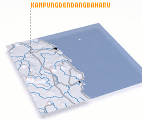 Places with similar names to Kampung Dendang Baharu, Malaysia ::
// Kampong Dendong B (MY)
Disclaimer :: Information on this page comes without warranty of any kind |
||
|
Where is Kampung Dendang Baharu? Elevation and coordinates ::
Latitude (lat): 4°48'0"N Longitude (lon): 103°11'0"E
Elevation (approx.): 20m (map arrows pan, magnifying glasses zoom) |
||
|
Visiting Kampung Dendang Baharu? Hotel/Accommodation ::
Book a hotel in Kampung Dendang Baharu Travel Guide ::
Buy a travel guide for Malaysia rental cars ::
car rental offers GPS waypoint ::
download a GPX waypoint (PoI) of Kampung Dendang Baharu for your GPS receiver
|
||