|
search place name
|
||
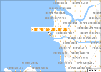
Kampung Kuala Muda (Kedah, Malaysia)Kampung Kuala Muda is a town in the Kedah region of Malaysia. An overview map of the region around Kampung Kuala Muda is displayed below.
regional and 3d topo map of Kampung Kuala Muda, Malaysia ::
Kampung Kuala Muda airports ::
The nearest airport is PEN - Penang Intl, located 32.3 km south of Kampung Kuala Muda.
Other airports nearby include AOR - Alor Setar Sultan Abdul Halim (67.4 km north), LGK - Pulau Langkawi Intl (106.3 km north west), IPH - Ipoh Sultan Azlan Shah (140.3 km south east), HDY - Songkhla Hat Yai Intl (149.4 km north), Nearby towns ::
Kampong Tepi Sungai (0.0km north) //
Kampung Kuala Sungai Muda (0.9km east) //
Kampong Kepala Jalan (1.8km east) //
Kampong Permatang Katong (1.8km east) //
Permatang Bendahari (3.7km east) //
Kampong Pulau Mertajam (3.7km east) //
Kampong Permatang Kelumpang (3.7km east) //
Kampong Permatang Nyior (3.7km east) //
Kampong Permatang Rawa (4.1km south east) //
Permatang Kerian (4.1km south east) //
Kampong Bakau Tua (4.1km south east) //
Kampong Sungai Kedak (4.1km south east) //
Kampong Permatang Kechik (4.1km north east) //
Kampong Paya (4.1km north east) //
Kampong Tahar (4.1km north east) //
Kampong Sungai Meriam (4.1km north east) //
Kampong Pasir Gebu (5.2km south east) //
Kampong Telok Pial (5.2km north east) //
Kampong Permatang Rengan (5.2km north east) //
Kampong Bukit Berangan (5.2km north east) //
Kampong Sintok Bugis (5.2km north east) //
Kampong Kota Aur (5.5km east) //
Kampong Seberang Terus (5.5km east) //
Kampong Baru (5.5km east) //
Kota (5.5km east) //
Kampong Ayer Jawi (5.5km east) //
Kampong Tok Otek (5.8km east) //
Kampong Pulau (5.8km east) //
Kampong Bukit Kechik (5.9km north) //
[all distances 'as the bird flies' and approximate] 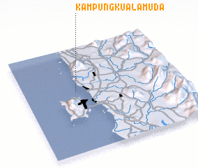 Places with similar names to Kampung Kuala Muda, Malaysia ::
Disclaimer :: Information on this page comes without warranty of any kind |
||
|
Where is Kampung Kuala Muda? Elevation and coordinates ::
Latitude (lat): 5°35'0"N Longitude (lon): 100°20'0"E
Elevation (approx.): -32768m (map arrows pan, magnifying glasses zoom) |
||
|
Visiting Kampung Kuala Muda? Hotel/Accommodation ::
Book a hotel in Kampung Kuala Muda Travel Guide ::
Buy a travel guide for Malaysia rental cars ::
car rental offers GPS waypoint ::
download a GPX waypoint (PoI) of Kampung Kuala Muda for your GPS receiver
|
||