|
search place name
|
||
Kampung Pulau Tawar (Pahang, Malaysia)Kampung Pulau Tawar is a town in the Pahang region of Malaysia. An overview map of the region around Kampung Pulau Tawar is displayed below.
regional and 3d topo map of Kampung Pulau Tawar, Malaysia ::

Kampung Pulau Tawar airports ::
The nearest airport is KUA - Kuantan, located 87.0 km east of Kampung Pulau Tawar.
Other airports nearby include KTE - Kerteh (131.9 km north east), KUL - Kuala Lumpur Intl (149.3 km south west), IPH - Ipoh Sultan Azlan Shah (167.0 km north west), MKZ - Malacca (180.3 km south), Nearby towns ::
Kampong Bandar (0.0km north) //
Kampong Masjid (0.0km north) //
Kampong Let Sermai (1.8km west) //
Kampong Kedondong (1.8km west) //
Kampong Kerayong (1.8km west) //
Kampong Perian (1.9km north) //
Kampong Merbau (1.9km north) //
Kampong Kempot (2.6km south east) //
Kampong Sokti (2.6km south east) //
Kampong Batu Leja (2.6km south east) //
Kampong Periba (2.6km north west) //
Kampong Gintong (3.7km south) //
Kampong Kuala Salan (3.7km north) //
Kampong Nyior (3.7km north) //
Kampong Tanjong (3.7km north) //
Kampong Sungai Batu (3.7km east) //
Kampong Bukit Wai (4.1km south west) //
Kampung Kelola (4.1km south east) //
Kampong Sungai Rong (4.1km north east) //
Kampong Pedah (5.6km north) //
Kampong Tanjong Rengas (5.6km north) //
Kampong Tebing Tinggi (5.9km south) //
Kampong Batu Kawah (5.9km south) //
Kampong Jeransang (6.7km south west) //
Kampung Kepala Pulau (7.4km south) //
Kampong Paya Tampak (7.4km north) //
Kampong Selat Pulau (7.4km north) //
Kampong Kepala (7.4km north) //
Kampong Pamah Dusun (7.4km north) //
[all distances 'as the bird flies' and approximate] 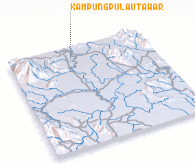 Places with similar names to Kampung Pulau Tawar, Malaysia :: Disclaimer :: Information on this page comes without warranty of any kind |
||
|
Where is Kampung Pulau Tawar? Elevation and coordinates ::
Latitude (lat): 3°53'0"N Longitude (lon): 102°26'0"E
Elevation (approx.): 55m (map arrows pan, magnifying glasses zoom) |
||
|
Visiting Kampung Pulau Tawar? Hotel/Accommodation ::
Book a hotel in Kampung Pulau Tawar Travel Guide ::
Buy a travel guide for Malaysia rental cars ::
car rental offers GPS waypoint ::
download a GPX waypoint (PoI) of Kampung Pulau Tawar for your GPS receiver
|
||