|
search place name
|
||
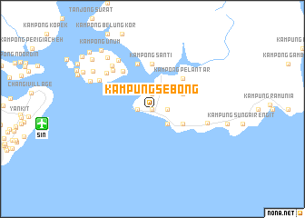
Kampung Sebong (Johor, Malaysia)Kampung Sebong is a town in the Johor region of Malaysia. An overview map of the region around Kampung Sebong is displayed below.
regional and 3d topo map of Kampung Sebong, Malaysia ::
Kampung Sebong airports ::
The nearest airport is SIN - Singapore Changi Intl, located 13.7 km west of Kampung Sebong.
Other airports nearby include QPG - Paya Lebar (23.1 km west), XSP - Singapore Seletar (28.3 km west), JHB - Johor Bahru Sultan Ismail (58.3 km north west), MKZ - Malacca (230.0 km north west), Nearby towns ::
Pengerang (0.0km north) //
Kampong Lanjut (1.9km north) //
Kampong Batu Mas (1.9km east) //
Kampung Baharu (1.9km west) //
Kampong Jawa Darat (2.6km south east) //
Kampung Jawa (2.6km south east) //
Kampong Jawa Laut (2.6km south east) //
Kampong Lepau (4.1km north east) //
Kampung Telok Ampang (4.1km south east) //
Kampung Langkah Baik (4.1km south east) //
Kampong Pelantar (5.2km north east) //
Kampong Santi (5.6km north) //
Pasir Gogok (5.9km north) //
Kampong Pasir (5.9km north west) //
Kampong Pengkalan Pakau (6.8km north west) //
Kampong Sungai Kapal (7.0km east) //
Kampong Sanyonkong Parit (7.2km north west) //
Kampong Ayer Samak Darat (7.2km north west) //
Kampong Ayer Samak (7.3km north west) //
Kampong Sanyongkong (7.4km north west) //
Kampong Batu Koyok (8.4km north west) //
Kampong Sungai Belang (8.4km north west) //
Chia Tong Quah Estate (8.7km north west) //
Sungai Unum Estate (9.6km north west) //
Kampong Unum (9.6km north west) //
Kampong Seminei (9.7km north west) //
Kampong Pasir Merah (10.4km north west) //
Kampong Permatang (10.8km north west) //
[all distances 'as the bird flies' and approximate] 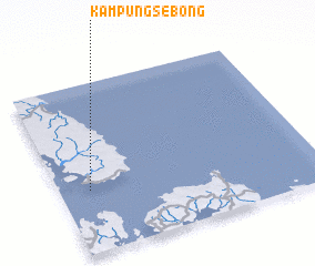 Places with similar names to Kampung Sebong, Malaysia ::
Disclaimer :: Information on this page comes without warranty of any kind |
||
|
Where is Kampung Sebong? Elevation and coordinates ::
Latitude (lat): 1°22'0"N Longitude (lon): 104°7'0"E
Elevation (approx.): 40m (map arrows pan, magnifying glasses zoom) |
||
|
Visiting Kampung Sebong? Hotel/Accommodation ::
Book a hotel in Kampung Sebong Travel Guide ::
Buy a travel guide for Malaysia rental cars ::
car rental offers GPS waypoint ::
download a GPX waypoint (PoI) of Kampung Sebong for your GPS receiver
|
||