|
search place name
|
||
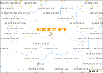
Kampung Tubeh (Sarawak, Malaysia)Kampung Tubeh is a town in the Sarawak region of Malaysia. An overview map of the region around Kampung Tubeh is displayed below.
regional and 3d topo map of Kampung Tubeh, Malaysia ::
Kampung Tubeh airports ::
The nearest airport is KCH - Kuching Intl, located 41.1 km north of Kampung Tubeh.
Other airports nearby include SQC - Sintang Susilo (166.8 km south east), PNK - Pontianak Supadio (178.7 km south west), SBW - Sibu (217.1 km north east), Nearby towns ::
Kampong Kohom (0.0km north) //
Kampong Sungan (5.2km south west) //
Kampung Tama (5.6km south) //
Kampong Pelaman Dunak (5.9km west) //
Kampong Subang (7.4km north) //
Kampong Sira (7.4km north) //
Kampong Merakap (7.4km west) //
Kampong Retoh (7.9km south east) //
Kampong Kakeng (7.9km north east) //
Kampong Sijijak (9.3km south west) //
Kampong Pelaman Bentang (10.5km north east) //
[all distances 'as the bird flies' and approximate] 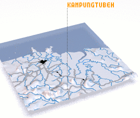 Places with similar names to Kampung Tubeh, Malaysia ::
// Kampong Taba (MY)
// Kampong Tabeh (MY)
// Kampong Tabo (MY)
// Kampong Taboh (MY)
// Kampong Teba (MY)
// Kampong Tiba (MY)
// Kampong Toboh (MY)
// Kampong Tubau (MY)
// Kampungtebu (ID)
// Kampong Gedabu (MY)
Disclaimer :: Information on this page comes without warranty of any kind |
||
|
Where is Kampung Tubeh? Elevation and coordinates ::
Latitude (lat): 1°7'0"N Longitude (lon): 110°24'0"E
Elevation (approx.): 67m (map arrows pan, magnifying glasses zoom) |
||
|
Visiting Kampung Tubeh? Hotel/Accommodation ::
Book a hotel in Kampung Tubeh Travel Guide ::
Buy a travel guide for Malaysia rental cars ::
car rental offers GPS waypoint ::
download a GPX waypoint (PoI) of Kampung Tubeh for your GPS receiver
|
||