|
search place name
|
||
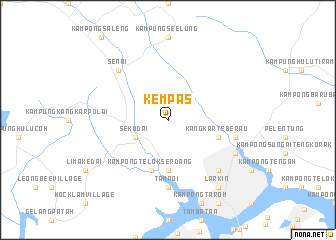
Kempas (Johor, Malaysia)Kempas is a town in the Johor region of Malaysia. An overview map of the region around Kempas is displayed below.
regional and 3d topo map of Kempas, Malaysia ::
Kempas airports ::
The nearest airport is JHB - Johor Bahru Sultan Ismail, located 10.6 km north of Kempas.
Other airports nearby include XSP - Singapore Seletar (23.8 km south east), QPG - Paya Lebar (31.4 km south east), SIN - Singapore Changi Intl (39.5 km south east), MKZ - Malacca (179.4 km north west), Nearby towns ::
Kampong Sekudai Laut (4.1km south west) //
Sekudai (4.1km south west) //
Kampong Pasir (5.6km south) //
Kangkar Teberau (5.9km east) //
Kampong Telok Serdang (5.9km south) //
Tampoi (7.4km south) //
Kampong Pandan (7.6km east) //
Kampong Kebun Teh (7.9km south east) //
Senai (7.9km north west) //
Kampong Melayu Majedee (8.3km south east) //
Larkin (9.3km south east) //
[all distances 'as the bird flies' and approximate] 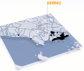 Places with similar names to Kempas, Malaysia ::
Disclaimer :: Information on this page comes without warranty of any kind |
||
|
Where is Kempas? Elevation and coordinates ::
Latitude (lat): 1°33'0"N Longitude (lon): 103°42'0"E
Elevation (approx.): 29m (map arrows pan, magnifying glasses zoom) |
||
|
Visiting Kempas? Hotel/Accommodation ::
Book a hotel in Kempas Travel Guide ::
Buy a travel guide for Malaysia rental cars ::
car rental offers GPS waypoint ::
download a GPX waypoint (PoI) of Kempas for your GPS receiver
|
||