|
search place name
|
||
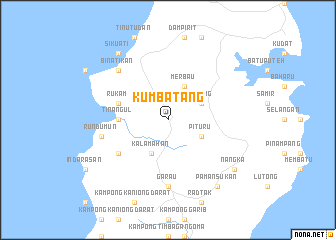
Kumbatang (Sabah, Malaysia)Kumbatang is a town in the Sabah region of Malaysia. An overview map of the region around Kumbatang is displayed below.
regional and 3d topo map of Kumbatang, Malaysia ::
Kumbatang airports ::
The nearest airport is BKI - Kota Kinabalu Intl, located 122.0 km south west of Kumbatang.
Other airports nearby include LBU - Labuan (233.4 km south west), LDU - Lahad Datu (265.7 km south east), BWN - Brunei Intl (286.5 km south west), Nearby towns ::
Dualog (4.1km north east) //
Merbau (4.1km north east) //
Pituru (4.1km south east) //
Kalamahan (4.1km south west) //
Tinangul (5.5km west) //
Rukam (5.8km west) //
Kirikan (6.6km south west) //
Kampong Narangdan (7.4km south) //
Garau (7.4km south) //
Rundumun (7.6km west) //
Binatikan (7.8km north west) //
Nangka (9.2km south east) //
Sikuati (9.2km north west) //
Kampong Penansukan (9.2km south east) //
Pamansukan (9.2km south east) //
[all distances 'as the bird flies' and approximate] 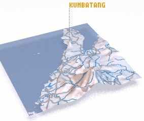 Places with similar names to Kumbatang, Malaysia ::
Disclaimer :: Information on this page comes without warranty of any kind |
||
|
Where is Kumbatang? Elevation and coordinates ::
Latitude (lat): 6°49'0"N Longitude (lon): 116°43'0"E
Elevation (approx.): 45m (map arrows pan, magnifying glasses zoom) |
||
|
Visiting Kumbatang? Hotel/Accommodation ::
Book a hotel in Kumbatang Travel Guide ::
Buy a travel guide for Malaysia rental cars ::
car rental offers GPS waypoint ::
download a GPX waypoint (PoI) of Kumbatang for your GPS receiver
|
||