|
search place name
|
||
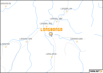
Long Banga (Sarawak, Malaysia)Long Banga is a town in the Sarawak region of Malaysia. An overview map of the region around Long Banga is displayed below.
regional and 3d topo map of Long Banga, Malaysia ::
Long Banga airports ::
The nearest airport is MUR - Marudi, located 160.0 km north west of Long Banga.
Other airports nearby include LMN - Limbang (182.6 km north), MYY - Miri (198.6 km north west), BWN - Brunei Intl (199.4 km north), Nearby towns ::
Long Balang (4.1km north west) //
Long Peluan (5.9km north) //
Long Lamai (7.4km south) //
[all distances 'as the bird flies' and approximate] 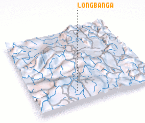 Places with similar names to Long Banga, Malaysia ::
// Lingbong (PH)
// Long Buang (MY)
// Long Buang (MY)
// Lungbunga (GH)
// Langbank (CA)
// Làng Bang (VN)
// Làng Bang (VN)
// Làng Băng (VN)
// Làng Băng (VN)
// Làng Bàng (VN)
Disclaimer :: Information on this page comes without warranty of any kind |
||
|
Where is Long Banga? Elevation and coordinates ::
Latitude (lat): 3°12'0"N Longitude (lon): 115°23'0"E
Elevation (approx.): 431m (map arrows pan, magnifying glasses zoom) |
||
|
Visiting Long Banga? Hotel/Accommodation ::
Book a hotel in Long Banga Travel Guide ::
Buy a travel guide for Malaysia rental cars ::
car rental offers GPS waypoint ::
download a GPX waypoint (PoI) of Long Banga for your GPS receiver
|
||