|
search place name
|
||
Padang Keria (Perlis, Malaysia)Padang Keria is a town in the Perlis region of Malaysia. An overview map of the region around Padang Keria is displayed below.
regional and 3d topo map of Padang Keria, Malaysia ::

Padang Keria airports ::
The nearest airport is AOR - Alor Setar Sultan Abdul Halim, located 25.9 km south east of Padang Keria.
Other airports nearby include LGK - Pulau Langkawi Intl (50.6 km west), HDY - Songkhla Hat Yai Intl (75.5 km north), PEN - Penang Intl (109.5 km south), PAN - Pattani (120.8 km north east), Nearby towns ::
Kampung Simpang Sanglang (1.8km east) //
Kampong Kerbau Belaga (1.8km east) //
Kampong Padang Gelanggang (1.8km east) //
Alor Pulai (1.8km east) //
Kampung Permatang Keriang (1.8km east) //
Kampung Rama (1.8km east) //
Kuala Sanglang (2.6km south east) //
Kampong Tok Mengkula (2.6km south east) //
Kampung Permatang Limau Manis (2.6km north west) //
Kampung Kepala Batas Pauh (2.6km north east) //
Permatang Kering (2.6km north east) //
Kampong Pisang (3.7km east) //
Kampong Sanglang (3.7km east) //
Sanglang (4.1km south east) //
Kampong Simpang (4.1km south east) //
Banir Tembus (4.1km north west) //
Kampung Sungai Padang (4.1km north west) //
Kampung Sungai Belati (4.1km north west) //
Permatang Bongor (4.1km north east) //
Kampong Lubok Gokgek (4.1km north east) //
Kampong Kuala Kerpan Kechil (5.2km south east) //
Kampong Permatang Haji Man (5.2km south east) //
Kampung Tok Pulau (5.2km north east) //
Kampong Permatang Kerengga (5.5km east) //
Kampong Padang China (5.5km east) //
Simpang Empat (5.6km north) //
Kampong Permatang Kenanga (5.8km east) //
Sungai Baharu (5.9km north) //
Kampong Jawi Keluang (5.8km east) //
[all distances 'as the bird flies' and approximate] 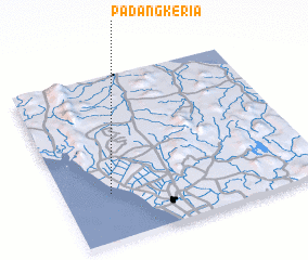 Places with similar names to Padang Keria, Malaysia :: Disclaimer :: Information on this page comes without warranty of any kind |
||
|
Where is Padang Keria? Elevation and coordinates ::
Latitude (lat): 6°17'0"N Longitude (lon): 100°11'0"E
Elevation (approx.): 3m (map arrows pan, magnifying glasses zoom) |
||
|
Visiting Padang Keria? Hotel/Accommodation ::
Book a hotel in Padang Keria Travel Guide ::
Buy a travel guide for Malaysia rental cars ::
car rental offers GPS waypoint ::
download a GPX waypoint (PoI) of Padang Keria for your GPS receiver
|
||