|
search place name
|
||
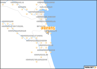
Parang (Terengganu, Malaysia)Parang is a town in the Terengganu region of Malaysia. An overview map of the region around Parang is displayed below.
regional and 3d topo map of Parang, Malaysia ::
Parang airports ::
The nearest airport is KTE - Kerteh, located 17.6 km south of Parang.
Other airports nearby include TGG - Kuala Terengganu Sultan Mahmud (84.7 km north west), KUA - Kuantan (105.0 km south), KBR - Kota Bahru Sultan Ismail Petra (206.6 km north west), NAW - Narathiwat (275.8 km north west), Nearby towns ::
Kampung Sura (1.0km north east) //
Kampong Pilor (3.4km south) //
Kampong Tebing Tembak (3.4km south) //
Kampong Rengit (3.4km south) //
Batu Lima (3.6km north west) //
Kampong Nyor (4.3km south west) //
Kampong Sura Masjid (4.3km north) //
Kampong Ima (4.8km west) //
Kampong Dusun Besar (4.8km west) //
Kampong Limbong (5.2km south) //
Kampong Kongsi (5.2km south) //
Paka (5.2km south) //
Kampong Nesar Tinggi (5.6km south west) //
Kampong Gong Gemorah (5.6km south west) //
Kampong Beril (5.8km south west) //
Kampong Pinang Merah (5.8km south west) //
Kampong Gong Paku (5.8km south west) //
Kampong Cherong Melintang (5.8km south west) //
Kampong Balai Besar (6.1km north) //
Kampong Pak Sabah (6.6km north west) //
Kampong Sura (6.6km north west) //
Tanjong Kepala Tumang (6.6km west) //
Kampong Kepala Tumang (6.6km west) //
Kampong Nyiur Sebatang (6.9km south west) //
Kampong Bukit Gelugor (6.9km south west) //
Kampong Taarong (6.9km south west) //
Kampong Baru (7.0km south) //
Kampong Gong Gemia (7.0km south) //
Kampong Molek (8.3km north) //
[all distances 'as the bird flies' and approximate] 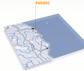 Places with similar names to Parang, Malaysia ::
Disclaimer :: Information on this page comes without warranty of any kind |
||
|
Where is Parang? Elevation and coordinates ::
Latitude (lat): 4°41'45"N Longitude (lon): 103°26'30"E
Elevation (approx.): 43m (map arrows pan, magnifying glasses zoom) |
||
|
Visiting Parang? Hotel/Accommodation ::
Book a hotel in Parang Travel Guide ::
Buy a travel guide for Malaysia rental cars ::
car rental offers GPS waypoint ::
download a GPX waypoint (PoI) of Parang for your GPS receiver
|
||