|
search place name
|
||
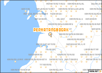
Permatang Bogak (Pulau Pinang, Malaysia)Permatang Bogak is a town in the Pulau Pinang region of Malaysia. An overview map of the region around Permatang Bogak is displayed below.
regional and 3d topo map of Permatang Bogak, Malaysia ::
Permatang Bogak airports ::
The nearest airport is PEN - Penang Intl, located 23.6 km north west of Permatang Bogak.
Other airports nearby include IPH - Ipoh Sultan Azlan Shah (98.5 km south east), AOR - Alor Setar Sultan Abdul Halim (109.7 km north), LGK - Pulau Langkawi Intl (149.3 km north west), PAN - Pattani (191.1 km north east), Nearby towns ::
Kampong Changkat (0.0km north) //
Kampong Bagan Buaya (2.6km north east) //
Kampong Jawi (3.7km east) //
Jawi (3.7km east) //
Nibung Tebal (4.1km south east) //
Badak Mati (4.1km north east) //
Kampong Makau Suah (4.1km north east) //
Makau Suah (4.1km north east) //
Sungai Bakap (4.1km north east) //
Kampong Permatang Ara (4.1km north east) //
Sungai To' Tuntong (4.1km south west) //
Kampong Sungai Udang Besar (4.1km south west) //
Kampong Gurun (5.2km north east) //
Kampong Masjid Baharu (5.2km north east) //
Kampong Sungai Udang Kechil (5.2km south west) //
Kampong Changkat Dain (5.5km east) //
Changkat Dain (5.5km east) //
Parit Tok Mandin (5.6km south) //
Telok Ipil (5.6km south) //
Tanjong Berembang (5.6km south) //
Rantau Panjang (5.6km south) //
Kampong Sungai Duri (5.8km east) //
Marang Ara (5.8km east) //
Wellesley (5.8km east) //
Sungai Lintah (5.8km east) //
Sungai Setar Besar (5.9km south) //
Ji Kongsi (6.7km north east) //
Val d'Or (6.7km north east) //
Kampong Telok (6.7km south east) //
[all distances 'as the bird flies' and approximate] 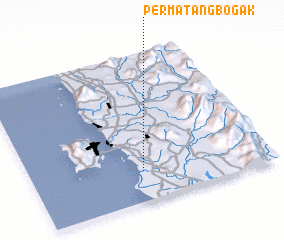 Places with similar names to Permatang Bogak, Malaysia :: Disclaimer :: Information on this page comes without warranty of any kind |
||
|
Where is Permatang Bogak? Elevation and coordinates ::
Latitude (lat): 5°12'0"N Longitude (lon): 100°28'0"E
Elevation (approx.): 7m (map arrows pan, magnifying glasses zoom) |
||
|
Visiting Permatang Bogak? Hotel/Accommodation ::
Book a hotel in Permatang Bogak Travel Guide ::
Buy a travel guide for Malaysia rental cars ::
car rental offers GPS waypoint ::
download a GPX waypoint (PoI) of Permatang Bogak for your GPS receiver
|
||