|
search place name
|
||
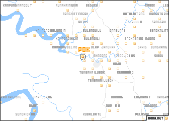
Pok (Sarawak, Malaysia)Pok is a town in the Sarawak region of Malaysia. An overview map of the region around Pok is displayed below.
regional and 3d topo map of Pok, Malaysia ::
Pok airports ::
The nearest airport is SBW - Sibu, located 107.9 km north east of Pok.
Other airports nearby include KCH - Kuching Intl (128.5 km west), SQC - Sintang Susilo (149.6 km south), BTU - Bintulu (253.5 km north east), Nearby towns ::
Bengang (0.0km north) //
Serian (1.9km north) //
Ban (1.9km south) //
Semumoh (1.9km east) //
Salulap (2.6km north east) //
Setambak Ulu (2.6km north west) //
Betong (2.6km south east) //
Melaban (2.6km south east) //
Empaong (3.7km east) //
Setambak Ili (4.1km north west) //
Kampong Belingan (4.1km north west) //
Buleng Ili (4.1km north east) //
Tembawai Lubok (4.1km south east) //
Pasa Atas (5.2km north east) //
Spaoh (5.2km north west) //
Kampong Hilir (5.2km north west) //
Tansang (5.2km south east) //
Bangai Kanah (5.6km east) //
Tusor (5.6km east) //
Bangai Kiba (5.6km east) //
Luban Ili (5.6km north) //
Jangkar (5.9km east) //
Tanu (5.9km east) //
Penurin (5.9km east) //
Kampong Ulu (5.9km north) //
Penggan (5.9km north) //
Buleng Ulu (5.9km north) //
Seruai (6.7km north west) //
Tembawai Lubok (6.7km south east) //
[all distances 'as the bird flies' and approximate]  Places with similar names to Pok, Malaysia ::
Disclaimer :: Information on this page comes without warranty of any kind |
||
|
Where is Pok? Elevation and coordinates ::
Latitude (lat): 1°25'0"N Longitude (lon): 111°30'0"E
Elevation (approx.): 7m (map arrows pan, magnifying glasses zoom) |
||
|
Visiting Pok? Hotel/Accommodation ::
Book a hotel in Pok Travel Guide ::
Buy a travel guide for Malaysia rental cars ::
car rental offers GPS waypoint ::
download a GPX waypoint (PoI) of Pok for your GPS receiver
|
||