|
search place name
|
||
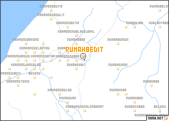
Rumah Bedit (Sarawak, Malaysia)Rumah Bedit is a town in the Sarawak region of Malaysia. An overview map of the region around Rumah Bedit is displayed below.
regional and 3d topo map of Rumah Bedit, Malaysia ::
Rumah Bedit airports ::
The nearest airport is MYY - Miri, located 26.7 km north of Rumah Bedit.
Other airports nearby include MUR - Marudi (42.6 km east), LMN - Limbang (142.4 km north east), BWN - Brunei Intl (144.4 km north east), BTU - Bintulu (148.1 km south west), Nearby towns ::
Rumah Gubang Tengah (1.8km west) //
Rumah Geran (1.8km west) //
Rumah Embit (2.6km south west) //
Kampong Subak (3.7km west) //
Rumah Tubam (4.1km north west) //
Rumah Abon (4.1km north west) //
Kampong Kuala Nosa (5.5km west) //
Kampong Kuala Kejapil (5.8km west) //
Kampong Kuala Kejapil (5.9km north) //
Kampong Sepurau (7.4km west) //
Rumah Simon (7.6km east) //
Sungai Mutap Kechil (8.3km south west) //
Kampong Sinop (8.3km south west) //
Kampong Butir (8.3km north west) //
Rumah Bungai (8.3km north east) //
Kampong Bulau (9.3km south west) //
Rumah Ikap (10.5km south east) //
[all distances 'as the bird flies' and approximate] 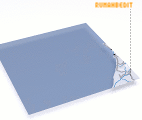 Places with similar names to Rumah Bedit, Malaysia ::
Disclaimer :: Information on this page comes without warranty of any kind |
||
|
Where is Rumah Bedit? Elevation and coordinates ::
Latitude (lat): 4°5'0"N Longitude (lon): 113°57'0"E
Elevation (approx.): 30m (map arrows pan, magnifying glasses zoom) |
||
|
Visiting Rumah Bedit? Hotel/Accommodation ::
Book a hotel in Rumah Bedit Travel Guide ::
Buy a travel guide for Malaysia rental cars ::
car rental offers GPS waypoint ::
download a GPX waypoint (PoI) of Rumah Bedit for your GPS receiver
|
||