|
search place name
|
||
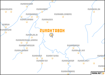
Rumah Taboh (Malaysia)Rumah Taboh is a town in Malaysia. An overview map of the region around Rumah Taboh is displayed below.
regional and 3d topo map of Rumah Taboh, Malaysia ::
Rumah Taboh airports ::
The nearest airport is BTU - Bintulu, located 44.3 km west of Rumah Taboh.
Other airports nearby include MYY - Miri (150.9 km north east), MUR - Marudi (157.3 km north east), SBW - Sibu (183.3 km south west), LMN - Limbang (260.2 km north east), Nearby towns ::
Rumah Inting (5.9km north) //
Rumah Usek (5.9km north) //
Rumah Tukau (7.4km south) //
Rumah Jalai (7.4km west) //
Rumah Bansa (8.3km south east) //
Rumah Manap (8.3km south west) //
Rumah Balombong (8.3km north east) //
Rumah Wen (9.3km south west) //
Rumah Berasap (9.3km north west) //
Pandan (9.3km north west) //
Rumah Masir (10.5km north west) //
[all distances 'as the bird flies' and approximate] 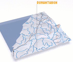 Places with similar names to Rumah Taboh, Malaysia ::
// Rumah Dabai (MY)
// Rumah Debu (MY)
// Rumah Taboh (MY)
// Rumah Tiboh (MY)
// Rumah Tuba (MY)
// Rumah Tuba (MY)
// Rumah Tubu (MY)
Disclaimer :: Information on this page comes without warranty of any kind |
||
|
Where is Rumah Taboh? Elevation and coordinates ::
Latitude (lat): 3°5'0"N Longitude (lon): 113°25'0"E
Elevation (approx.): 19m (map arrows pan, magnifying glasses zoom) |
||
|
Visiting Rumah Taboh? Hotel/Accommodation ::
Book a hotel in Rumah Taboh Travel Guide ::
Buy a travel guide for Malaysia rental cars ::
car rental offers GPS waypoint ::
download a GPX waypoint (PoI) of Rumah Taboh for your GPS receiver
|
||