|
search place name
|
||
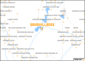
Sakai Villages (Perak, Malaysia)Sakai Villages is a town in the Perak region of Malaysia. An overview map of the region around Sakai Villages is displayed below.
regional and 3d topo map of Sakai Villages, Malaysia ::
Sakai Villages airports ::
The nearest airport is IPH - Ipoh Sultan Azlan Shah, located 37.1 km north of Sakai Villages.
Other airports nearby include PEN - Penang Intl (146.7 km north west), KUL - Kuala Lumpur Intl (179.4 km south east), AOR - Alor Setar Sultan Abdul Halim (228.7 km north), KBR - Kota Bahru Sultan Ismail Petra (253.4 km north east), Nearby towns ::
Kampong Changkat Pinggan (0.0km north) //
Kampong Pulau Penebok (0.0km north) //
Kampong Bukit Pekan (2.6km north east) //
Kampong Baharu Lombong Teronoh (4.1km north east) //
Kampong Timah (5.9km north) //
Kampong Sungai Lesong (7.4km east) //
Kampong Balun Bidai (7.6km west) //
Kampong Ayer Hitam Labu (7.9km north east) //
Kampong Mendeling (7.9km north east) //
Kampong Lesong (8.3km south west) //
[all distances 'as the bird flies' and approximate]  Places with similar names to Sakai Villages, Malaysia :: Disclaimer :: Information on this page comes without warranty of any kind |
||
|
Where is Sakai Villages? Elevation and coordinates ::
Latitude (lat): 4°14'0"N Longitude (lon): 101°4'0"E
Elevation (approx.): 15m (map arrows pan, magnifying glasses zoom) |
||
|
Visiting Sakai Villages? Hotel/Accommodation ::
Book a hotel in Sakai Villages Travel Guide ::
Buy a travel guide for Malaysia rental cars ::
car rental offers GPS waypoint ::
download a GPX waypoint (PoI) of Sakai Villages for your GPS receiver
|
||