|
search place name
|
||
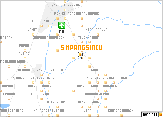
Simpang Sindu (Perak, Malaysia)Simpang Sindu is a town in the Perak region of Malaysia. An overview map of the region around Simpang Sindu is displayed below.
regional and 3d topo map of Simpang Sindu, Malaysia ::
Simpang Sindu airports ::
The nearest airport is IPH - Ipoh Sultan Azlan Shah, located 8.8 km north west of Simpang Sindu.
Other airports nearby include PEN - Penang Intl (129.6 km north west), AOR - Alor Setar Sultan Abdul Halim (203.8 km north west), KUL - Kuala Lumpur Intl (204.3 km south), KBR - Kota Bahru Sultan Ismail Petra (224.7 km north east), Nearby towns ::
Kampong Kurnia (0.0km north) //
Kampong Paya Rengas (1.8km west) //
Kampong Pengkalan (1.8km west) //
Kampong Tualang Tujoh (1.8km west) //
Kampong Kepayang (1.9km north) //
Kampong Kurnia (1.9km north) //
New Kopisan (1.8km east) //
Kampong Lalang (2.6km south east) //
Simpang Pulai (3.7km north) //
Telok Kangor (4.1km north east) //
Gopeng (5.2km south east) //
Kampong Sengat (5.9km north) //
Kampong Changkat Larang (5.8km west) //
Kampong Meranti Lapan (5.8km west) //
Klida Lawan (5.9km south) //
Sakai Village (6.7km south east) //
Keramat Pulai (6.7km north east) //
Kampung Pulai (6.7km south east) //
Gunong Rapat New Village (7.4km north) //
Kampong Changkat Tualang (7.6km south) //
Kampong Pinji (7.9km north west) //
Kampong Gunong Mesah Hulu (7.9km south east) //
Kampong Sungai Itek (7.9km south east) //
Kampong Kuala Punti (8.3km north west) //
Kampong Peng Pegoh (8.3km north west) //
Kampong Batu Dua (8.3km south west) //
Kampong Gunong Panjang (8.3km south east) //
Kampong Gunong Mesah Hilir (8.3km south east) //
Kampong Bakap (9.2km south west) //
[all distances 'as the bird flies' and approximate] 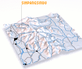 Places with similar names to Simpang Sindu, Malaysia :: Disclaimer :: Information on this page comes without warranty of any kind |
||
|
Where is Simpang Sindu? Elevation and coordinates ::
Latitude (lat): 4°30'0"N Longitude (lon): 101°8'0"E
Elevation (approx.): 49m (map arrows pan, magnifying glasses zoom) |
||
|
Visiting Simpang Sindu? Hotel/Accommodation ::
Book a hotel in Simpang Sindu Travel Guide ::
Buy a travel guide for Malaysia rental cars ::
car rental offers GPS waypoint ::
download a GPX waypoint (PoI) of Simpang Sindu for your GPS receiver
|
||