|
search place name
|
||
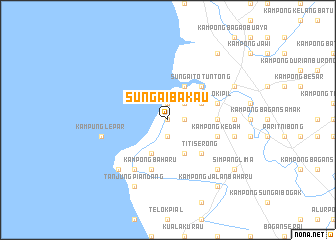
Sungai Bakau (Pulau Pinang, Malaysia)Sungai Bakau is a town in the Pulau Pinang region of Malaysia. An overview map of the region around Sungai Bakau is displayed below.
regional and 3d topo map of Sungai Bakau, Malaysia ::
Sungai Bakau airports ::
The nearest airport is PEN - Penang Intl, located 23.8 km north west of Sungai Bakau.
Other airports nearby include IPH - Ipoh Sultan Azlan Shah (97.6 km south east), AOR - Alor Setar Sultan Abdul Halim (116.8 km north), LGK - Pulau Langkawi Intl (152.7 km north west), HDY - Songkhla Hat Yai Intl (199.1 km north), Nearby towns ::
Kampong Tebok Jawa (0.0km north) //
Kampong Sungai Tongkang (0.0km north) //
Bagan Tiang (1.9km south) //
Kampong Sungai Kota (1.9km south) //
Kampong Surau (1.8km east) //
Kampung Sungai Aceh (1.9km north) //
Kampong Tengah (2.6km north east) //
Kampong Parit To'Ngah (4.1km south east) //
Kampong Sungai Megat Aris (4.1km south west) //
Sungai Setar Besar (4.1km north east) //
Kampong Sungai Udang Kechil (4.1km north east) //
Titi Serong (5.2km south east) //
Kampong Sungai Udang Besar (5.2km north east) //
Sungai To' Tuntong (5.2km north east) //
Permatang Keling (5.5km east) //
Kampong Sungai Setar (5.5km east) //
Kampong Kedah (5.8km east) //
Kampong Baharu (5.9km south) //
Parit Tok Mandin (5.8km east) //
Rantau Panjang (5.8km east) //
Tanjong Berembang (5.8km east) //
Telok Ipil (5.8km east) //
Kampong Tengah (6.7km south west) //
Kampong Permatang To' Mahat (7.4km east) //
Simpang Tiga (7.6km east) //
Kampung Lepar (7.6km west) //
Kampong Tok Sirun (7.8km south west) //
Kampong Tanah Kebun (7.8km south east) //
Tanjung Piandang (8.3km south west) //
[all distances 'as the bird flies' and approximate]  Places with similar names to Sungai Bakau, Malaysia ::
// Saung Bauk (MM)
// Seingbaik (MM)
// Zangbega (BF)
// Songaibaku (ID)
// Sungaibakaiy (ID)
// Sungaibakau (ID)
// Sangbok (KP)
// Sŏngbuk (KP)
// Sénéguébougou (ML)
// Soungobougou (ML)
Disclaimer :: Information on this page comes without warranty of any kind |
||
|
Where is Sungai Bakau? Elevation and coordinates ::
Latitude (lat): 5°8'0"N Longitude (lon): 100°25'0"E
Elevation (approx.): 3m (map arrows pan, magnifying glasses zoom) |
||
|
Visiting Sungai Bakau? Hotel/Accommodation ::
Book a hotel in Sungai Bakau Travel Guide ::
Buy a travel guide for Malaysia rental cars ::
car rental offers GPS waypoint ::
download a GPX waypoint (PoI) of Sungai Bakau for your GPS receiver
|
||