|
search place name
|
||
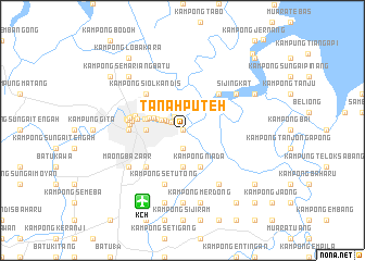
Tanah Puteh (Sarawak, Malaysia)Tanah Puteh is a town in the Sarawak region of Malaysia. An overview map of the region around Tanah Puteh is displayed below.
regional and 3d topo map of Tanah Puteh, Malaysia ::
Tanah Puteh airports ::
The nearest airport is KCH - Kuching Intl, located 8.3 km south west of Tanah Puteh.
Other airports nearby include SBW - Sibu (194.8 km north east), SQC - Sintang Susilo (204.3 km south east), PNK - Pontianak Supadio (217.4 km south west), Nearby towns ::
Kampong Sungai Periok (0.0km north) //
Biawak (0.0km north) //
Tanah Putch (0.0km north) //
Sungai Apong Fishing Village (0.0km north) //
Pending (0.0km north) //
Kampung Baru (1.5km north west) //
Kampung Matu (1.6km north west) //
Kampung Pulau Hilir (1.8km north west) //
Kampong Tabuan (1.9km south) //
Kampung Pulau Ulu (2.1km north west) //
Kampung Semarang (2.5km north west) //
Kampung Panglima Seman Lama (2.9km north west) //
Kampung Panglima Seman Ulu (3.3km north west) //
Kampung Bintawa (3.5km north west) //
Kampung Surabaya (3.6km west) //
Lintang (3.7km north east) //
Kampong Lahu (3.7km south) //
Kampung Boyan (3.7km west) //
Kampung Gersik (3.8km west) //
Kampung Boyan (4.0km west) //
Kampong Niada (4.1km south east) //
Pangkalan Batu (4.8km west) //
Kampung Sungai Bedil Besar (5.1km west) //
Kampong Tabuan (5.2km south west) //
Kampong Siol Kandis (5.2km north west) //
Kampong Tanjong Bako (5.2km north east) //
Kampung Masjid (5.3km west) //
Kampung Lintang (5.4km west) //
Kampung Haii Taha (5.5km west) //
[all distances 'as the bird flies' and approximate] 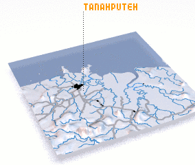 Places with similar names to Tanah Puteh, Malaysia ::
// Dinapit (PH)
// Tanah Puteh (MY)
// Tanah Putih (MY)
// Taniapéta (BJ)
// Tanippādi (IN)
// Tanahputih (ID)
// Tanahputih (ID)
// Tanahputih (ID)
// Tanahputih (ID)
// Tanaputih (ID)
Disclaimer :: Information on this page comes without warranty of any kind |
||
|
Where is Tanah Puteh? Elevation and coordinates ::
Latitude (lat): 1°33'0"N Longitude (lon): 110°23'0"E
Elevation (approx.): 20m (map arrows pan, magnifying glasses zoom) |
||
|
Visiting Tanah Puteh? Hotel/Accommodation ::
Book a hotel in Tanah Puteh Travel Guide ::
Buy a travel guide for Malaysia rental cars ::
car rental offers GPS waypoint ::
download a GPX waypoint (PoI) of Tanah Puteh for your GPS receiver
|
||