|
search place name
|
||
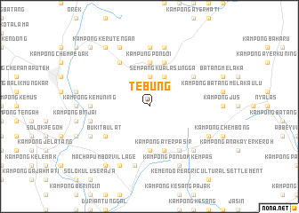
Tebung (Melaka, Malaysia)Tebung is a town in the Melaka region of Malaysia. An overview map of the region around Tebung is displayed below.
regional and 3d topo map of Tebung, Malaysia ::
Tebung airports ::
The nearest airport is MKZ - Malacca, located 20.9 km south west of Tebung.
Other airports nearby include KUL - Kuala Lumpur Intl (77.4 km north west), DUM - Dumai Pinang Kampai (135.4 km south west), JHB - Johor Bahru Sultan Ismail (172.5 km south east), KUA - Kuantan (177.5 km north east), Nearby towns ::
Kuala Sungga (3.7km north) //
Sempang Kuala Sungga (4.1km north east) //
Kampong Solok Kuala Sungga (4.1km north east) //
Kampung Pondoi (5.6km north) //
Kampong Ayer Pasir (5.6km south) //
Kampong Machap Baharu (5.6km south) //
Kampong Solok Bukit Putus (5.9km north) //
Kampong Ayer Bangkong (5.9km south) //
Kampong Ayer Pasir (5.9km south) //
Kampong Tanjong Alai (6.7km north west) //
Bukit Bulat (6.7km south west) //
Kampong Tengah (6.7km south east) //
On Lok Village (6.7km north east) //
Kampong Kemuning (7.4km west) //
Kampong Ulu Pondoi (7.4km north) //
Machap Lama (7.6km south) //
Kampong Punggor (7.6km west) //
Kampong Tebong Dalam (7.6km north) //
Selandar (7.9km south east) //
Kampong Selandar (7.9km south east) //
Machap Umbor (8.3km south west) //
Tanjong Si Akap (8.3km south west) //
Kampong Pondok Kempas (8.3km south east) //
Kampong Bukit Senggeh (8.3km south east) //
Kampong Ulu Dusun (8.3km north west) //
Machap Umbor Village (9.3km south west) //
Kampong Ulu Keru (9.3km north west) //
Kampong Keru Tengan (9.3km north west) //
Kampong Repah (10.5km north west) //
[all distances 'as the bird flies' and approximate]  Places with similar names to Tebung, Malaysia ::
Disclaimer :: Information on this page comes without warranty of any kind |
||
|
Where is Tebung? Elevation and coordinates ::
Latitude (lat): 2°26'0"N Longitude (lon): 102°20'0"E
Elevation (approx.): 64m (map arrows pan, magnifying glasses zoom) |
||
|
Visiting Tebung? Hotel/Accommodation ::
Book a hotel in Tebung Travel Guide ::
Buy a travel guide for Malaysia rental cars ::
car rental offers GPS waypoint ::
download a GPX waypoint (PoI) of Tebung for your GPS receiver
|
||